The Malham Circular Walk is a fantastic easy to moderate 8-9 kilometre (roughly 5.5 mile) well trafficked loop in the stunning Yorkshire Dales, England. It is sometimes referred to as the Malham Landscape Trail.
The walk consists of three segments which visit Malham’s most iconic landmarks: Janet’s Foss (waterfall), Gordale Scar (gorge) and the wonderfully intriguing limestone paving and amphitheatre cliffs of Malham Cove.
The Malham Circular Walk epitomises the varied offerings of the Yorkshire Dales. On this walk expect stunning green undulating hills criss-crossed by ancient dry stone walls, crystal clear trickling streams cutting through sheep-trimmed grass, expansive national park views and incredible natural rock formations and waterfalls.
Please note that this version of the Malham walk is shorter as it skips scrambling up the steep Gordale Scar. In winter Gordale Scar often turns into a gushing waterfall and is very slippery. After rainfall, it is best to treat the Gordale Scar part as an out-and-back walk, instead continuing the route via a footpath off the main lane.
The Malham Circular Walk without the Gordale Scar scramble will take around 2.5 – 3 hours. This accounts for photography stops (or stops to just take in the incredible scenery), and time for a picnic lunch.
Whether a regular local or a first-time visitor to the Yorkshire Dales National Park, the Malham Circular Walk is a spectacular show-off hike – even in winter.
Here is a step-by-step guide of how to do the wonderful, shorter version of the Malham Circular Walk in North Yorkshire, as well as some other useful information to help prepare you.
*This post may contain affiliate links meaning should you purchase a product via this link, I’ll earn a small commission at no extra cost to you. See my privacy and disclosure policy for more.*
PIN FOR LATER:
Getting to Malham
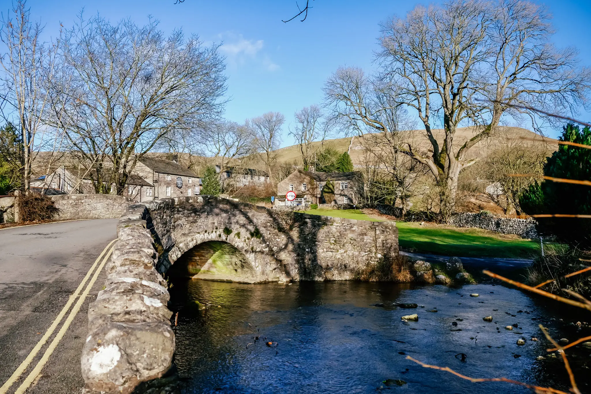
The small village of Malham is nestled to the south west of the Yorkshire Dales near Skipton. Pre 20th century, it was once part of the Rural District of Settle in the West Riding of Yorkshire.
Malham is best accessed by car. It is 20 minutes through the winding hills of the Dales from the market town of Skipton. From Harrogate it is an hour drive and York 1.5 hours.
There are also public mini buses that run from Skipton and Gargrave to Malham all year round. In the summer, there are infrequent services from Bradford, Ilkley, Skipton, Settle, Lancaster, Ingleton and Malham Tarn. Check out the Dales Bus website for timetables, ticket prices and routes.
If you’re just visiting and don’t have much time but want to see as much as possible, I would consider going on a day tour like this Malham Cove Walking Tour.
Part 1: Malham to Janet’s Foss
Distance: roughly 1.6 miles (2.5km)
Length: 30 minutes
Terrain: Generally flat on a well-formed gravel footpath. A short rocky incline for roughly 2 minutes to reach the waterfall
Directions and walk characteristics:
Starting from the National Park Visitor Centre car park or adjacent overflow field, turn left and head along the road in the direction of Malham centre for only a minute or two.
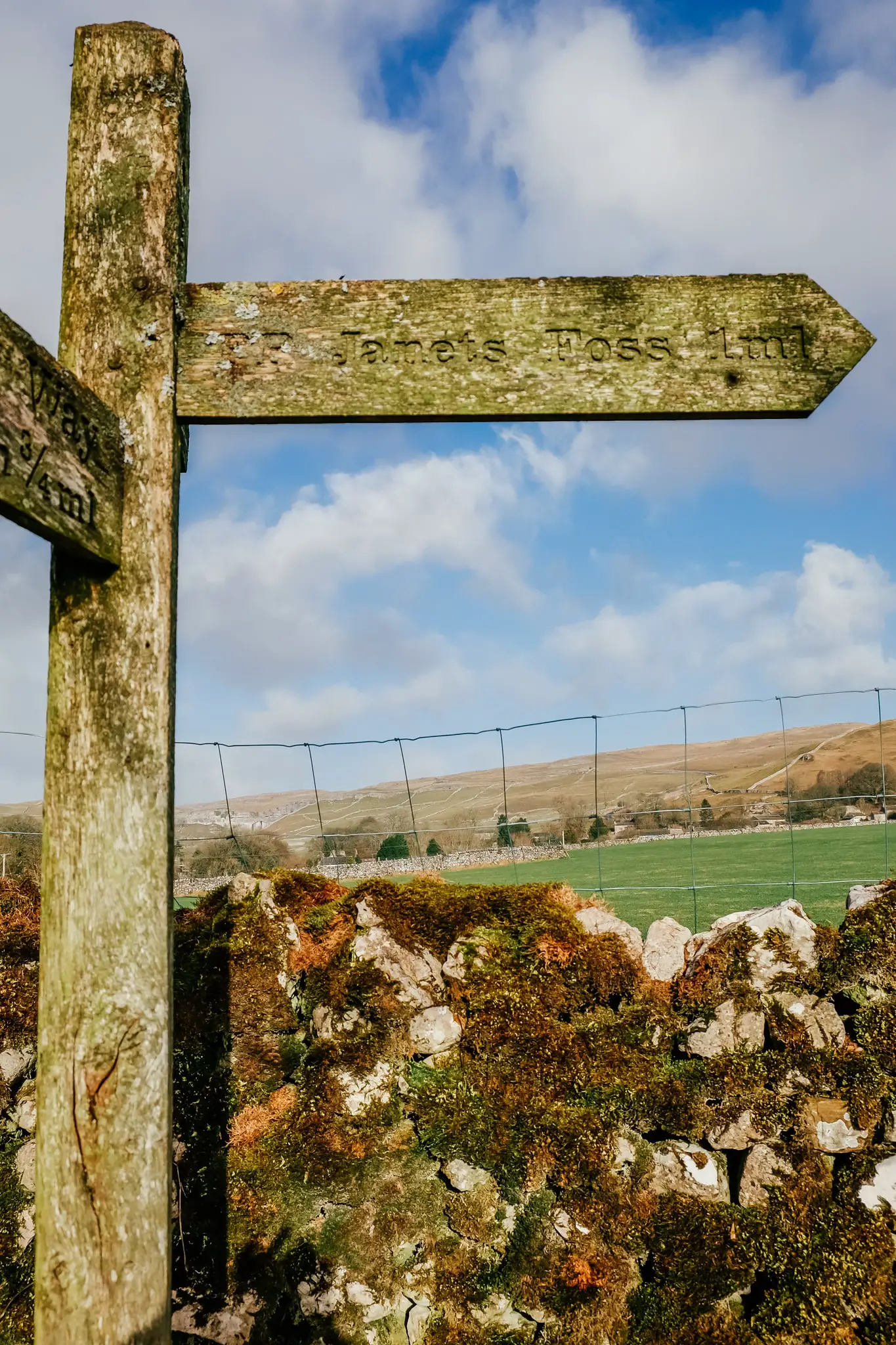
Just in front of the Malham Smithy, take the immediate right over the stone clapper footbridge across the river, which is signposted to Janet’s Foss.
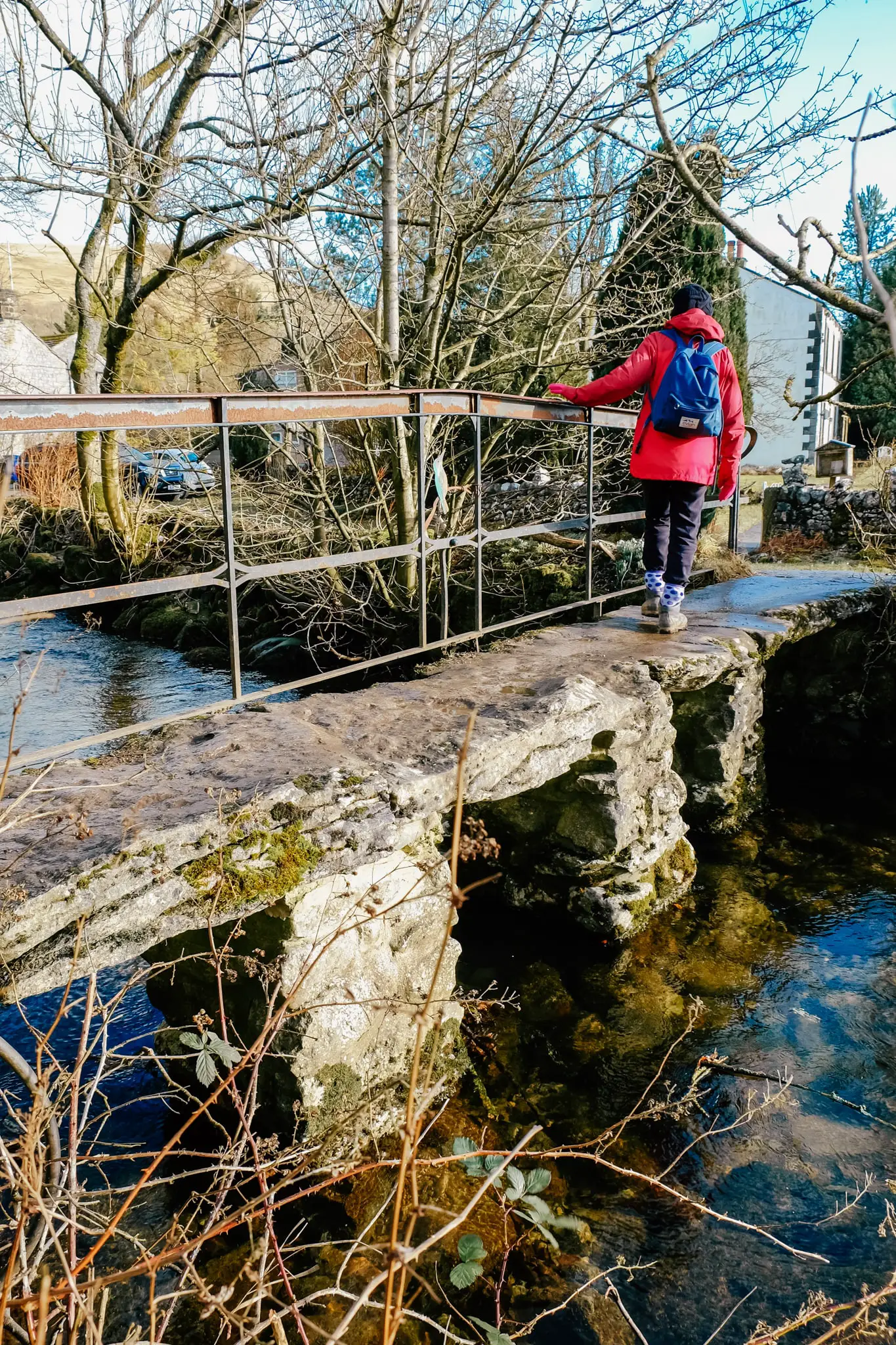
After the bridge, turn right onto the Pennine Way. Follow the footpath through fields, past old stone barns and alongside the river. Pass through the wooden kissing gates and into the National Trust owned woodland
In winter the woodland is pretty bare aside from the odd evergreen tree such as holly bushes, but it’s still an atmospheric part of the route. It’s damp and mossy but in Spring it’s carpeted in wild garlic and bluebells.
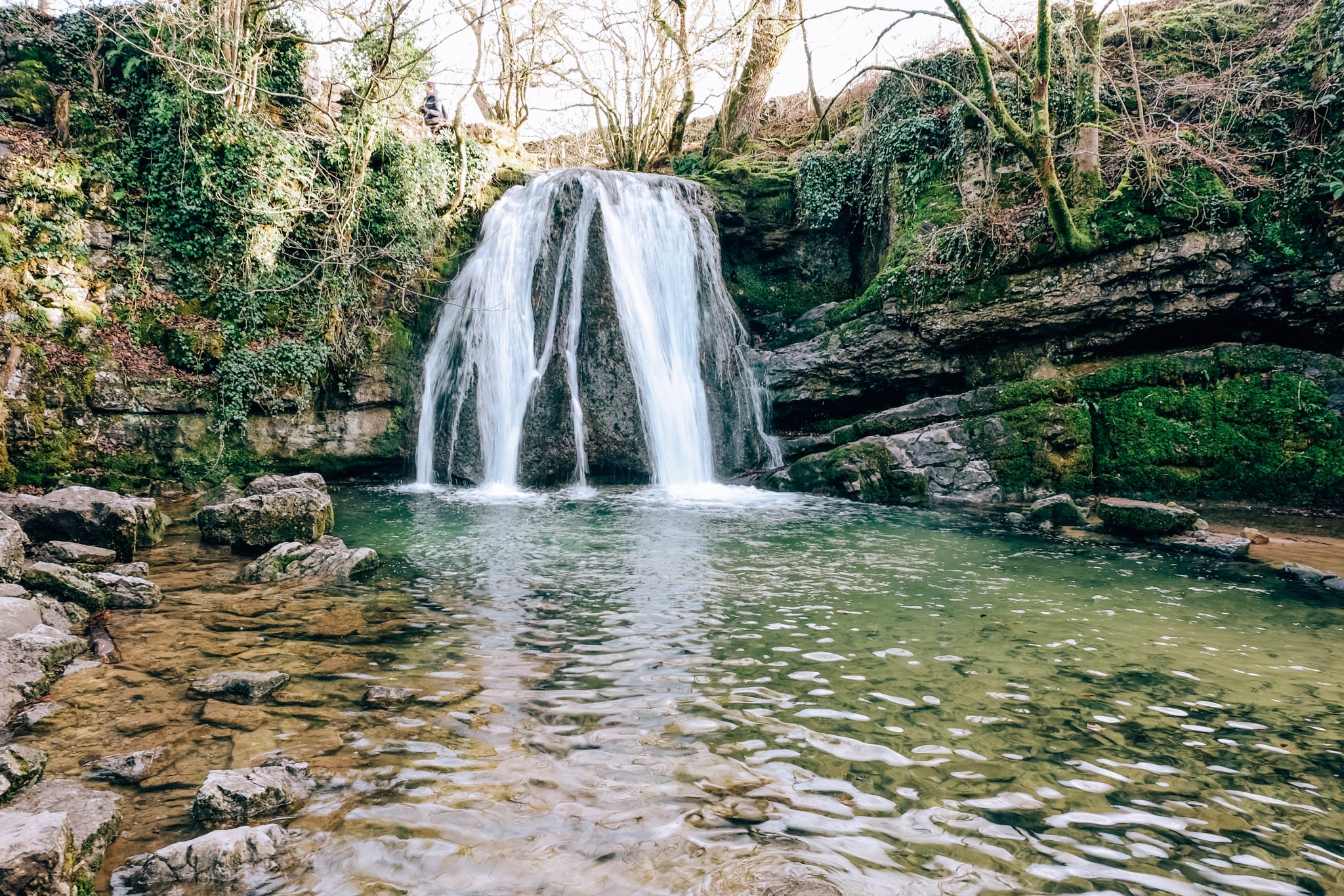
A short incline leads to the spectacular small waterfall, Janet’s Foss. Water from Gordale Beck flows over a limestone outcrop and falls into a large refreshing-looking pool below. The setting makes it one of the prettiest waterfalls in the Yorkshire Dales.
I was surprised at just how clear and enticing the water looked even in January. Despite the cold conditions, two brave women went in for a swim, and apparently it’s a popular local spot for a bit of wild swimming!
History of Janet’s Foss
The unusually named waterfall has an intriguing meaning behind it. According to folklore, Janet (or Jennet) is the Queen of the Fairies and she lives in the small cave to the right of the waterfall. The mossy banks, surrounding pretty woodland and dappled light certainly make this spot a worthy home for such a magical creature.
It was also said to have been once inhabited by humans – copper miners working at the nearby Pikedaw mines.
The second part of the name – foss, is the nordic word for waterfall which is still used in many parts of Scandinavia.
The pool at Janet’s Foss was traditionally used for sheep dipping in the 1800s, which is the immersion of sheep in water containing insecticides and fungicides. The regular event drew in many local inhabitants to watch.
Since the polluting practice stopped, it is now a popular tourist spot for visitors to Malham and for wild swimmers who visit all year round.
Part 2: Janet’s Foss to Gordale Scar
Distance: roughly 0.6 miles (1km)
Length: 15 minutes
Terrain: Steep very short scramble getting out of Janet’s Foss. Flat tarmacked road followed by a wide flat gravel footpath to the Scar.
Directions and walk characteristics:
Once you’ve soaked up the beauty of Janet’s Foss, take the path up to the left past the waterfall and through the kissing gate. Turn right into the lane and walk along it past the small stone bridge and refreshment van to your left.
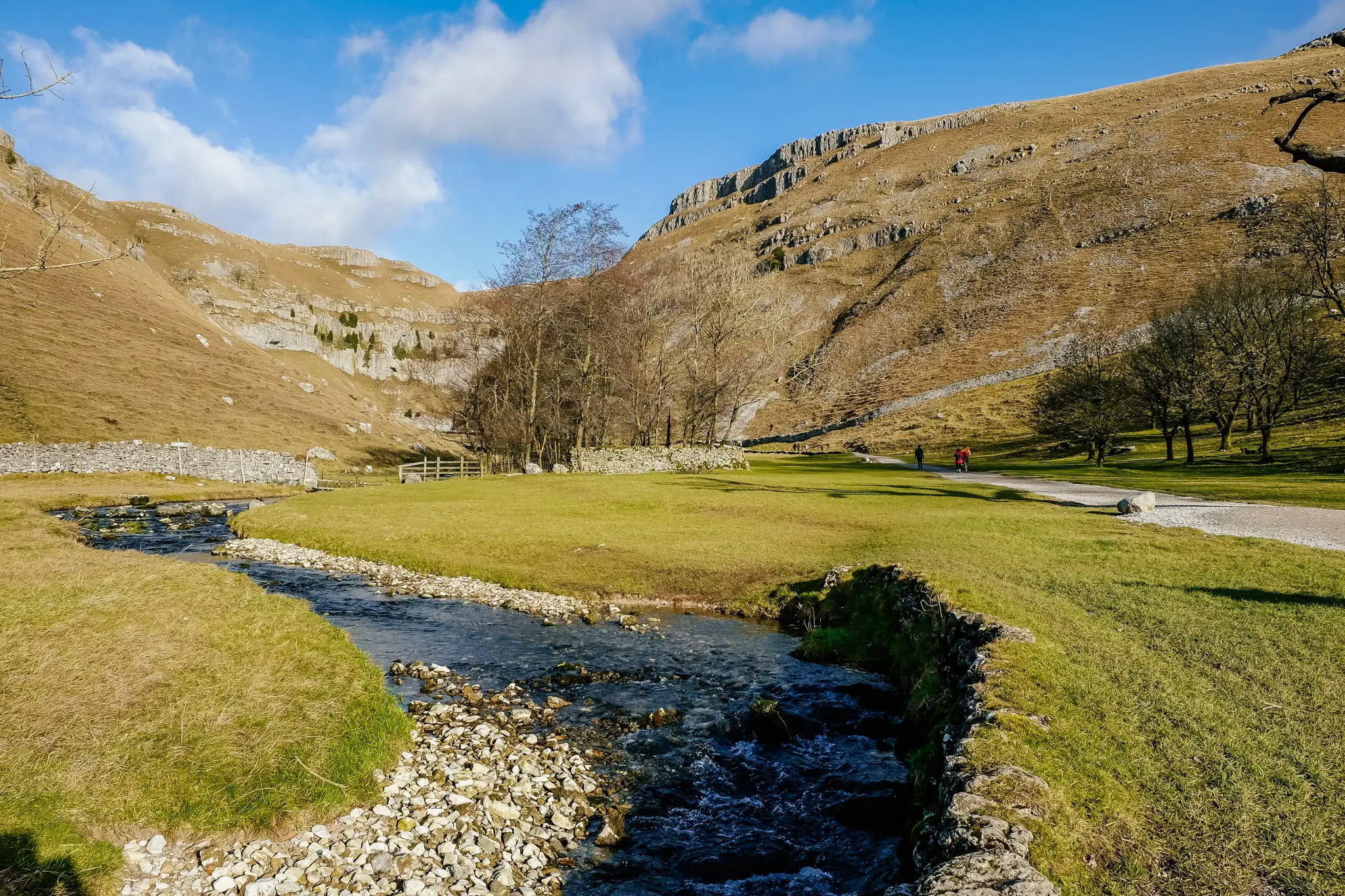
As the road bends to the right, take the gate to the left which is signposted to Gordale Scar. Initially you walk through the lovely flat green grass of the Gordale Scar private campground with an extremely pretty steam running through it.
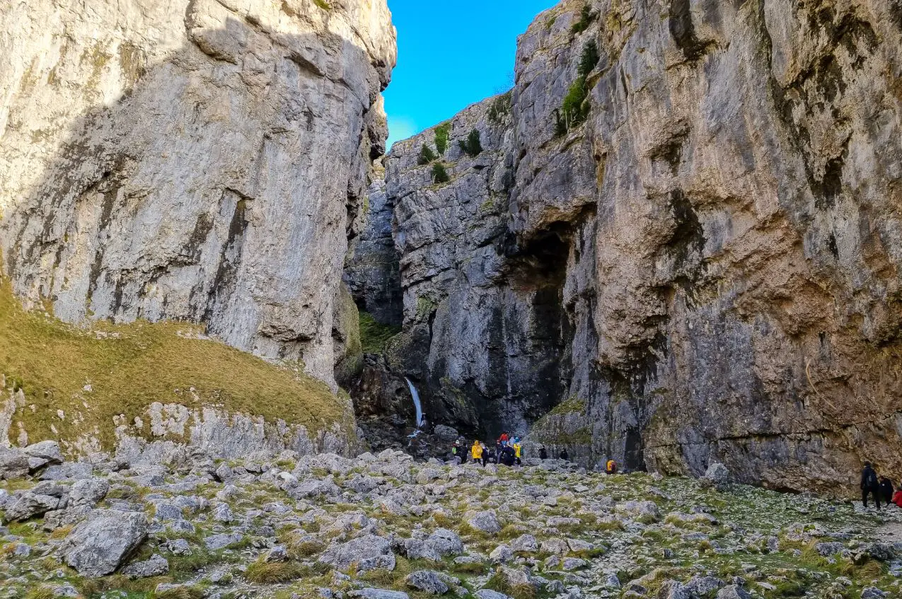
Up ahead lies a stunning sight to behold – the 100m high sheer rock faces of the Scar (a limestone gorge or ravine) either side of you. The scale of the Scar is certainly epic and will make you feel tiny!
At the end of the gorge, Gordale Beck falls over two rocky precipices which flow to form the stream, winding its way back down to Janet’s Foss where you have just come from.
In summer or after little rain, there is only one large stream of water to the right of the lower waterfall. However in winter and after rain, a second stream of water forms to the left.
There is actually a right of way up through the middle of the gorge’s lower waterfalls which requires about 10ft (3 metres) of scrambling on tufa (limestone deposits). This route would lead to Malham Moor and then on to Malham Tarn.
Obviously in winter or after rain, climbing up is not possible (unless you are very brave and have waterproof gear!) The alternative is to head back the way you came out of Gordale Scar. Continue the Malham Circular Walk via a footpath over the fields, skipping the moor and tarn.
History of Gordale Scar
Gordale Scar is a magnificent gorge thought to have been formed in the Ice Age by water melting from glaciers, eroding the rock and causing a vast cavern to collapse. The rock here is limestone, a common type of carbonate sedimentary rock.
Gordale Scar is somewhere around 15-16 million years old and is one of Britain’s most impressive gorges.
More recently, Gordale Scar appeared on the Netflix series The Witcher (S2 E3: What is Lost).
In fact, this is not the only filming location on this walk! The next section to the iconic limestone pavements of Malham Cove is also the setting of a scene in a famous book-adapted film. Keep reading to find out what!
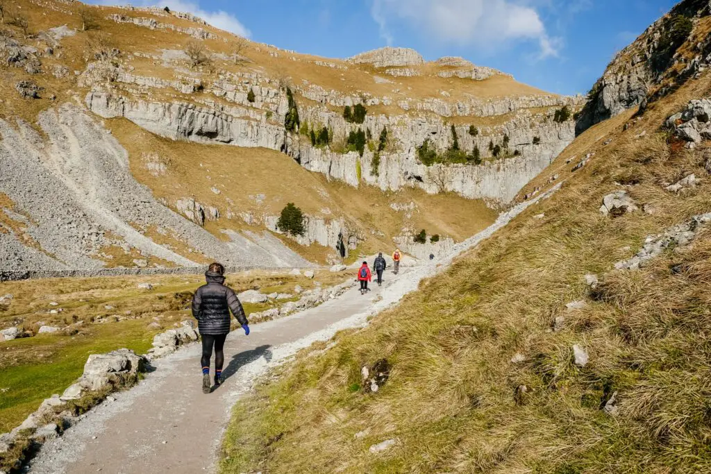
Part 3: Gordale Scar to Malham Cove
Distance: roughly 2.2 miles (3.5km)
Length: 1 hour
Terrain: Primarily deceptively steep and exposed footpaths through fields and across the top of hills. Some very muddy sections. This is the most challenging part of the walk.
Directions and walk characteristics:
Exiting Gordale Scar from the gate you entered, turn right back towards the way you came. Take the footpath behind the stone bridge and next to the refreshment van, up across a field.
Go up the stone steps through the kissing gate at the end of the field, and turn left towards the sign to Malham Cove.
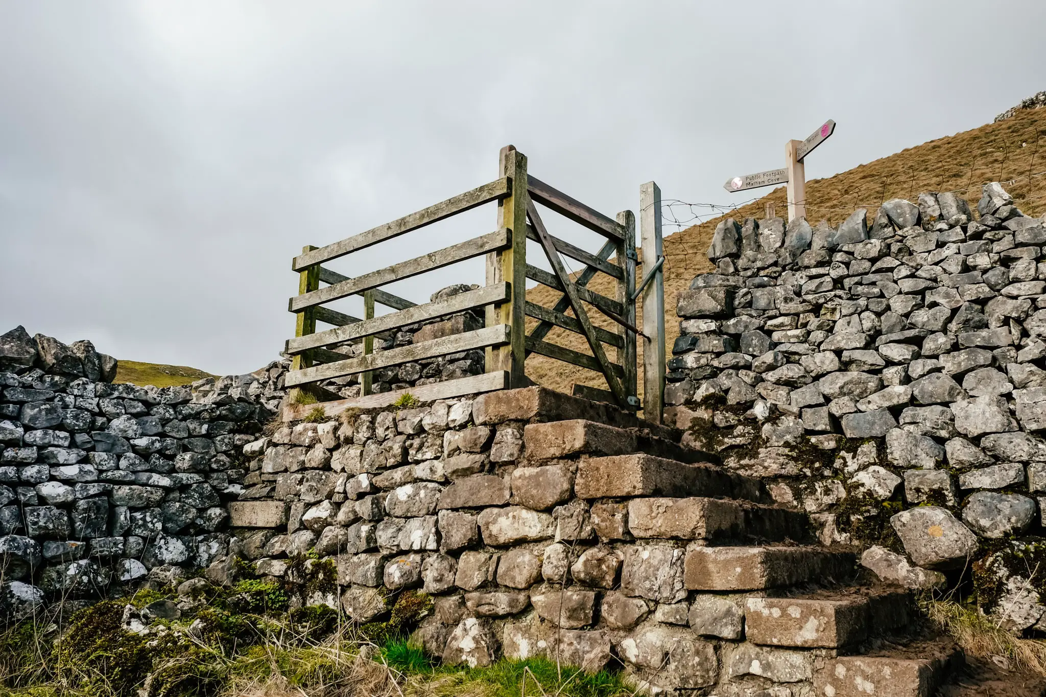
Follow the footpath all the way across fields and alongside pretty stone walls until you reach a kissing gate at a lane. Go through the gate, cross the lane with care (as it’s on a corner) and climb the steep wooden steps (stile) over the wall, directly ahead of you.
I did this walk during a weather warning with 55mph winds, and this section after the stile was especially tough as it is high, exposed and the wind whips straight across the dales. It does mean there are fabulous views here though!
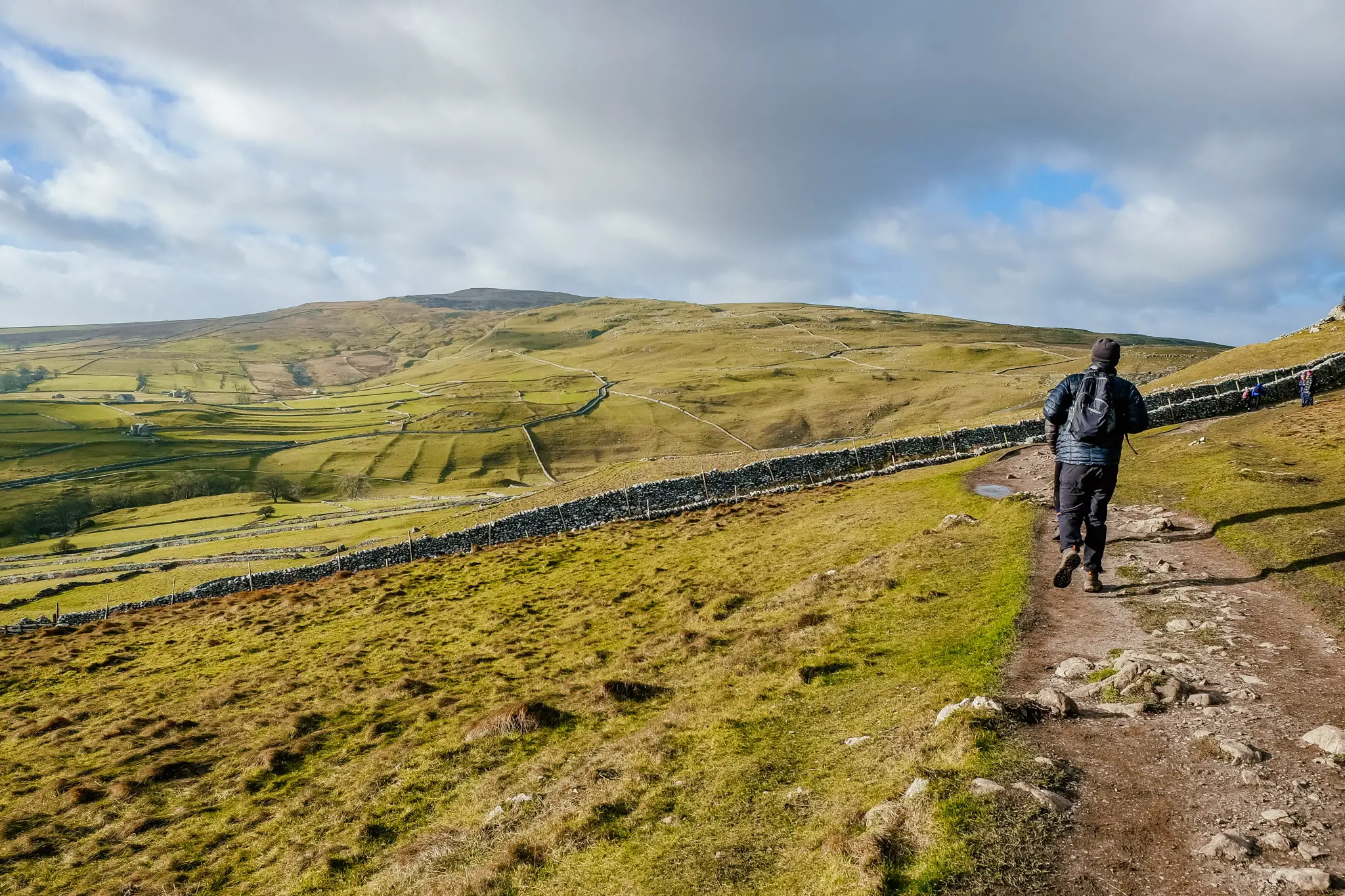
Continue the gradual uphill walk all the way to what appears to be a footpath junction with a signpost. Take the path to the left, slightly downhill in the direction of Malham Cove.
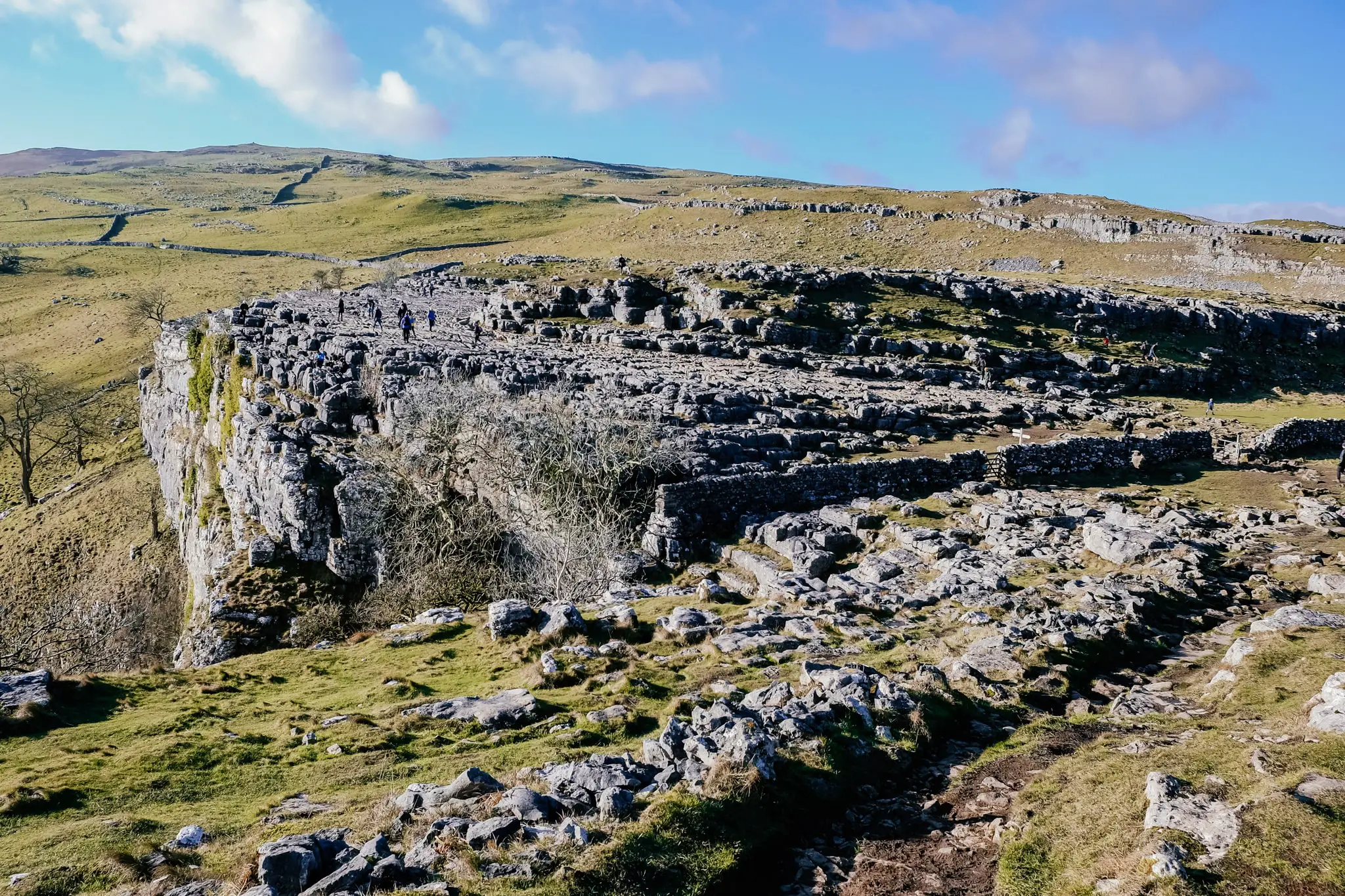
Go through the metal gate which exits onto the wonderful limestone pavement with clints (the flatter sections you can walk on) intersped with crevasses and gullies (grykes).
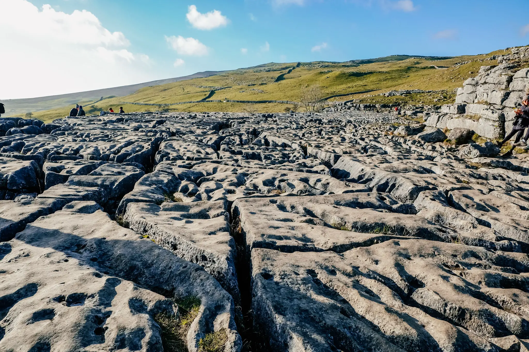
The clints are great fun to walk on, hopping from section to section. If it’s wet, take extra care as some of the grykes are deep and you would not want to slip in them! You may need to carry small children or small dogs over the paving to stop them falling in.
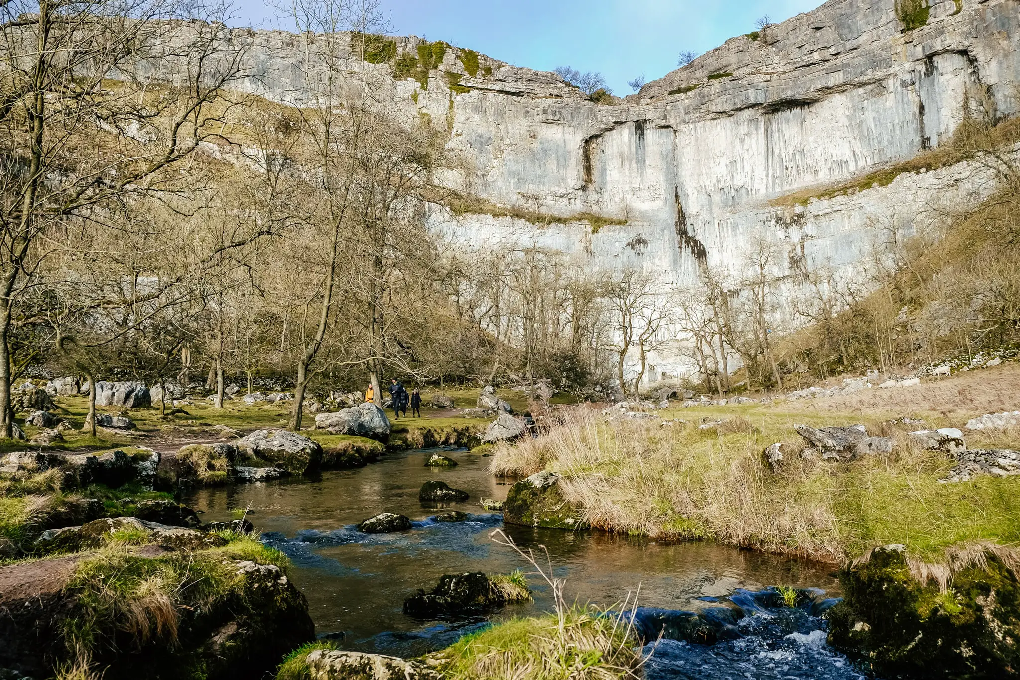
The cove itself is a huge semi circular 300m wide rock face and 80m high. When you exit the pavement and head down, you will get a much better view of the cove cliff face. However up at the top on the pavement, you will need to take care because it is a sheer 80m drop down!
The limestone pavement of Malham Cove is a great picnic spot, with some sheltered nooks you can huddle behind to eat lunch if it is windy.
History of Malham Cove
Malham Cove is a huge amphitheatre shaped limestone rock face which was formed over 12,000 years ago by a waterfall carrying meltwater from glaciers at the end of the last Ice Age. The rock face itself is a popular place for rock climbers all year round.
The karst paving at the top of the Cove is a unique incised pattern which is rarely seen in England. Over time retreating glaciers scraped away and exposed horizontally bedded limestone, then rain (particularly acid rain) corroded joints and cracks, creating fissures and small cavities between the rock.
The intriguing pavement formation has been the set of many films including the 1992 version of Emily Bronte’s Wuthering Heights and more recently, a scene in Harry Potter and the Deathly Hallows (part 1) filmed in 2009.
Part 4: Malham Cove to Malham Centre/ Visitor Centre
Distance: roughly 1 mile (1.6km)
Length: 30 minutes
Terrain: The limestone paving is very uneven with crevasses. Steps down towards the cove are steep and potentially slippery from mud or water. The footpath towards the lane is slightly uphill and the lane back to the village is downhill and well tarmacked.
Directions and walk characteristics:
Once you’re done exploring the limestone paving at the top of the cove, you will need to walk across the paving in the opposite direction you arrived. Take a sharp left through a wooden kissing gate where the cove ends, and a dry stone wall starts. I initially missed the exit as it’s a little hidden.
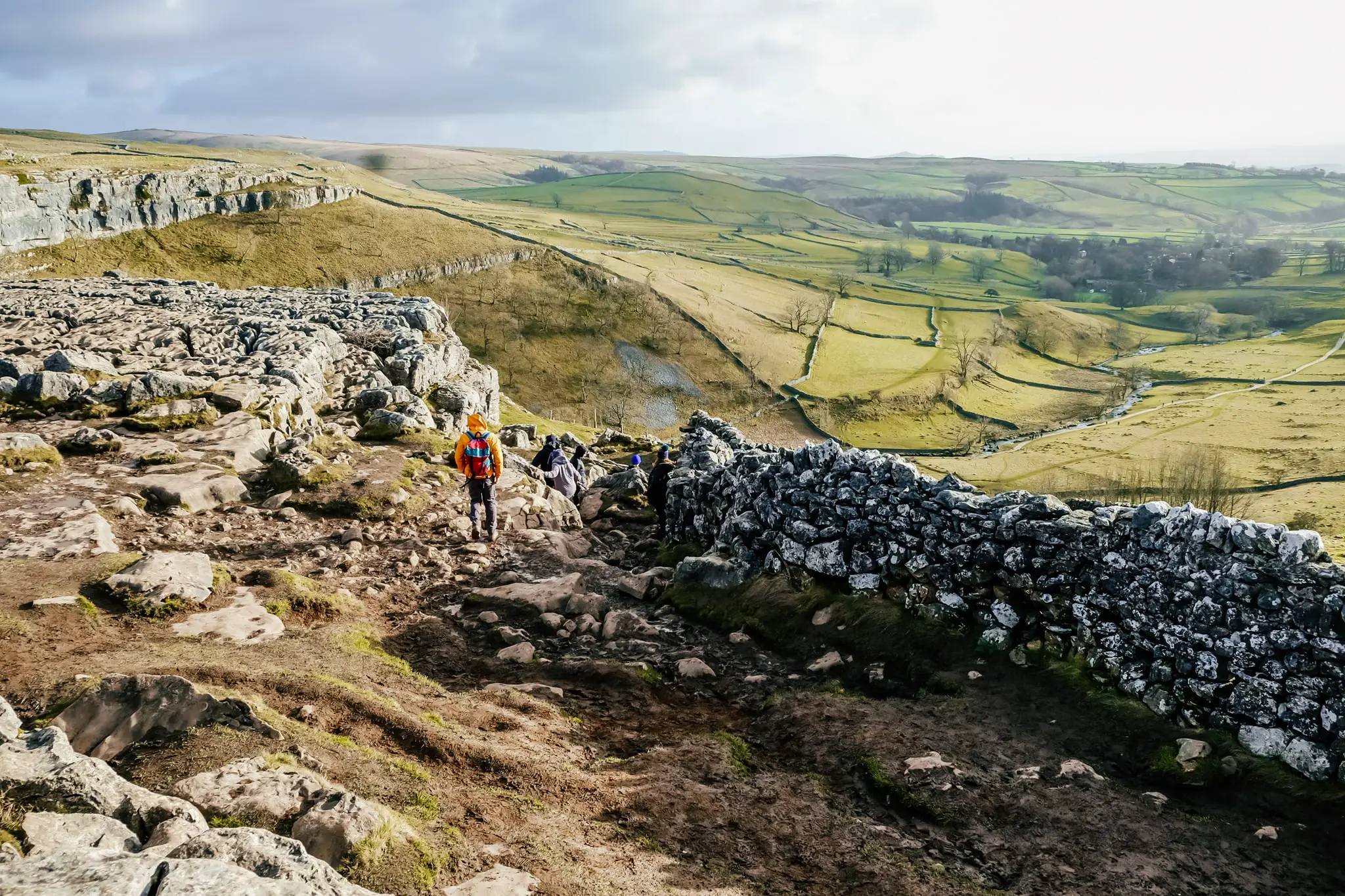
Walk down the steep stone steps, ensuring you take a look to your left to see the magnificent Malham Cove! If you have knee problems, you may need to take this downhill section slow, especially if it’s raining and slippery.
At the bottom, walk left to get a fantastic view of the cove with a foreground of the stream.
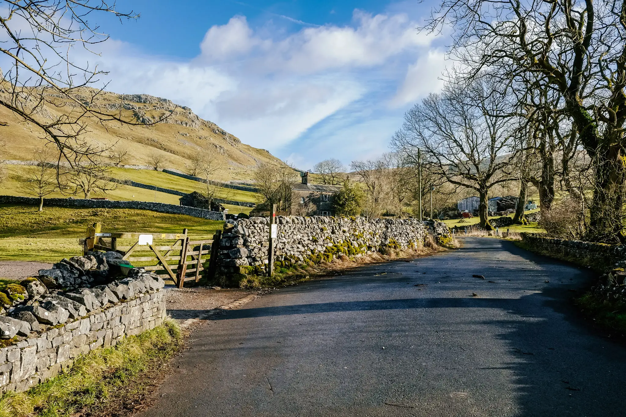
When you’re ready, head away from the Cove, following the footpath. The footpath meets a lane which you need to follow all the way back into the centre of town, and to your car.
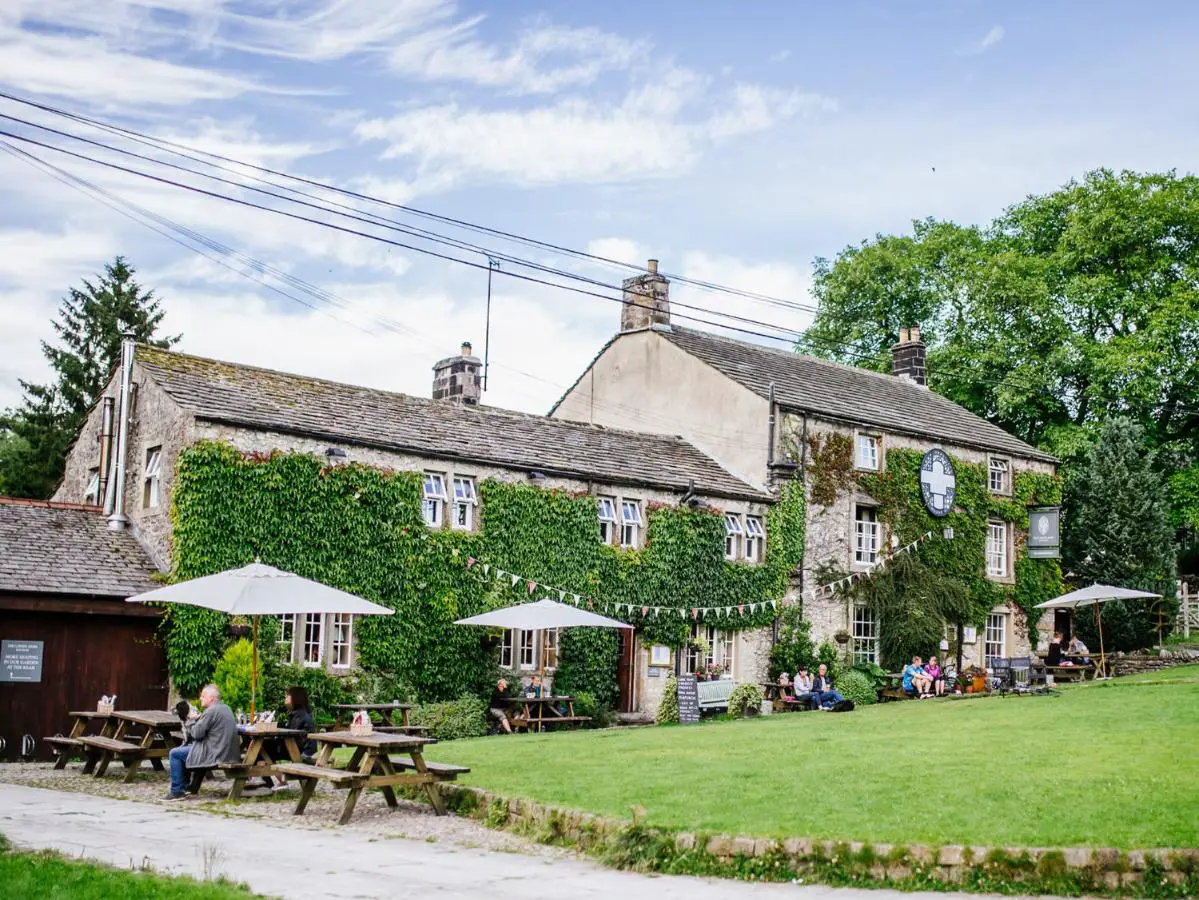
There are plenty of pubs and tea rooms in Malham, many of which you will walk past as you return to your car. If you fancy a pint or a pub lunch, try the Buck Inn, or for tea and something a bit lighter (or sweeter!), try the popular Old Barn Tearoom.
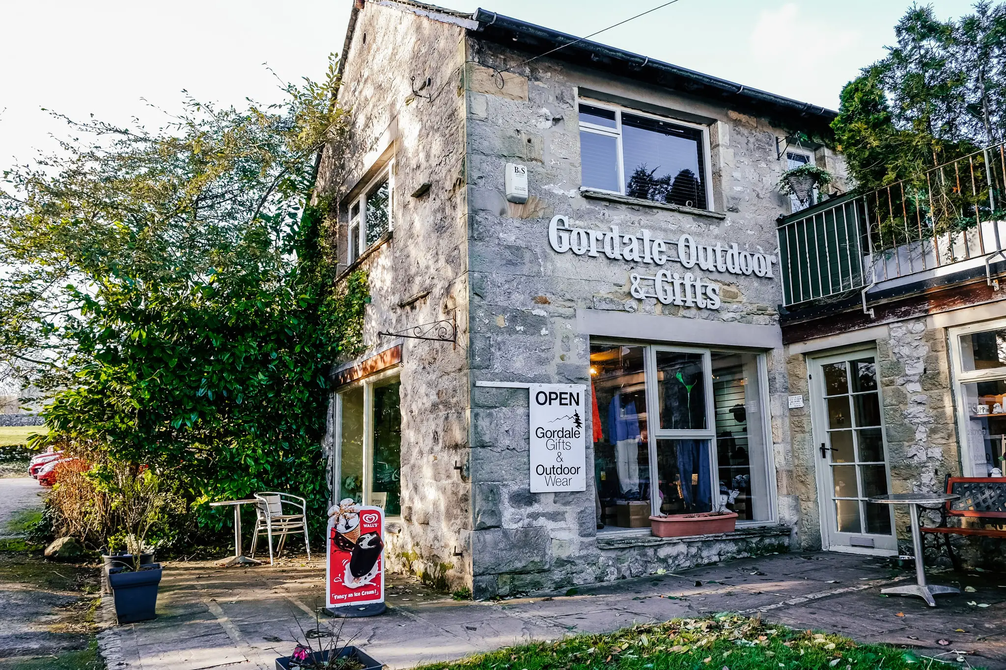
There is also an outdoor & gift shop on the road just before the tearoom, a candle shop and of course the Malham Smithy to check out.
The Malham Circular Walk is a distinctive walking trail showing off some of the best geological wonders in the country, let alone in Yorkshire. It is no wonder that it draws keen walkers from all over the world! It really is the Yorkshire Dales in one neat 9km package.
The popular track is ideal for people who want to experience some fantastic sights whilst getting some exercise, without having to overly exert themselves. It’s also a kid-friendly walk for budding adventurers.
Tips to know before you go to Malham:
- Malham Cove is a tourist trap and is generally heaving all year around. My last visit was in January 2022 during a severe weather warning (55-60mph winds) and it was still busy. Go early and avoid the summer and school holidays if you want to attempt to miss the crowds.
- The route is very well sign-posted and footpaths heavily trafficked all year round. As long as you have a general idea of the order of attack, you do not need a map or GPS navigation guidance.
- The National Park Visitor Centre has limited parking. Additional parking can be found along the road (£2 donation) or in a field beside the centre, which costs £5 all day. Make sure you have cash to pay the person on entry to the overflow carpark.
- Free drinking water and toilets can be found at the Visitor Centre (even when the centre is closed).
- This route is generally flat and would suit keen walkers of all ages.
- Malham Pavement can be very slippery during or after rain. Care should be taken when walking on it so you don’t slip into the crevasses. You will likely have to carry small children or dogs across it.
- Bringing a picnic to eat on Malham Pavement at the top of Malham Cove to take in the expansive view is recommended. However there are plenty of pubs and tea rooms in Malham for either before or after the walk if preferred.
- A lot of the walk is muddy. Comfortable, weather proof footwear is a must.
Recommended accommodation
Got longer than a day? Want to tackle this walk slowly, one section at a time? I would highly recommend that you stay overnight either in Malham or nearby town/village in the Yorkshire Dales if you can!
Here are some recommended hotel and B&B options for every budget:
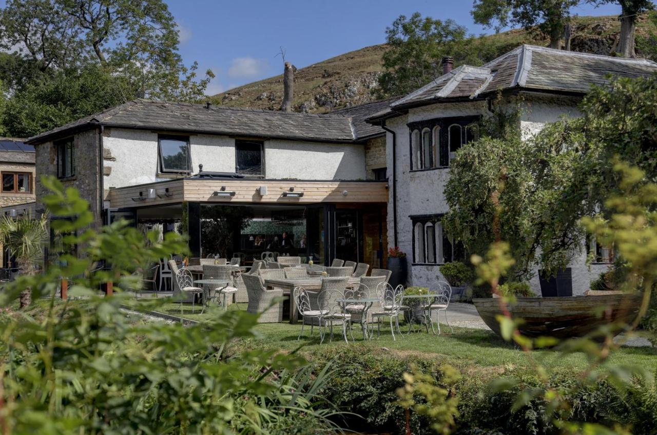
The Lister Arms (sleeps 2)
The Lister Arms is a quintessential English pub and AA 4-star 18th-century inn located in the heart of Malham, offering home-cooked food and good-value cosy accommodation with en-suite rooms.
View property
Beck Hall (sleeps 2)
Beck Hall is a dog-friendly hotel and bistro located in Malham. All 21 rooms at the property offer en-suite facilities. Guests can enjoy walks from the property’s doorstep, including the Malham Circular walk!
View property
Green Grove Country House (sleeps 10)
This 160 year-old cottage is set on the edge of the Yorkshire Dales National Park in Bell Busk. It offers spacious accommodation for a larger group or family (5 rooms) with countryside views, 7 miles from Skipton.
View property.
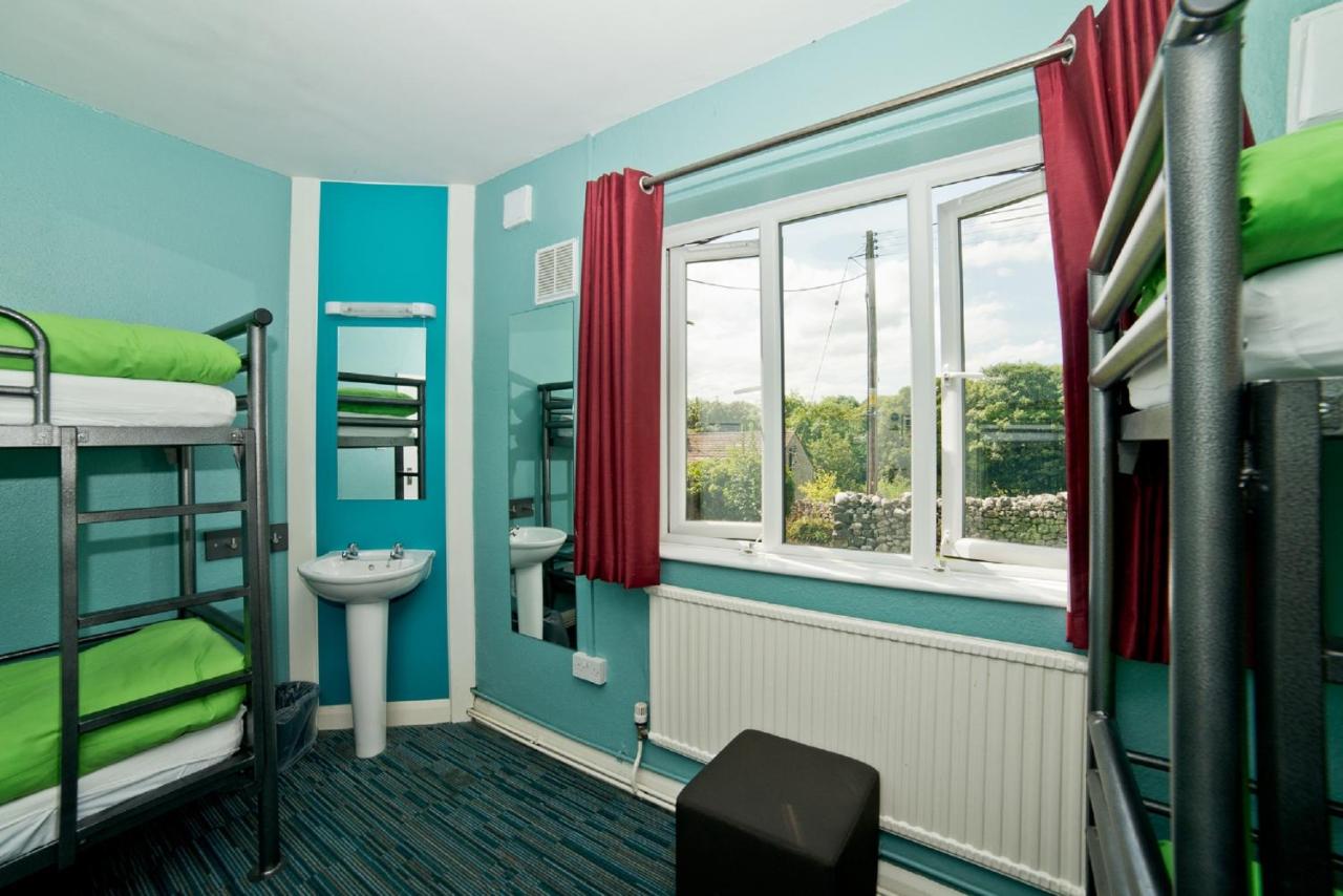
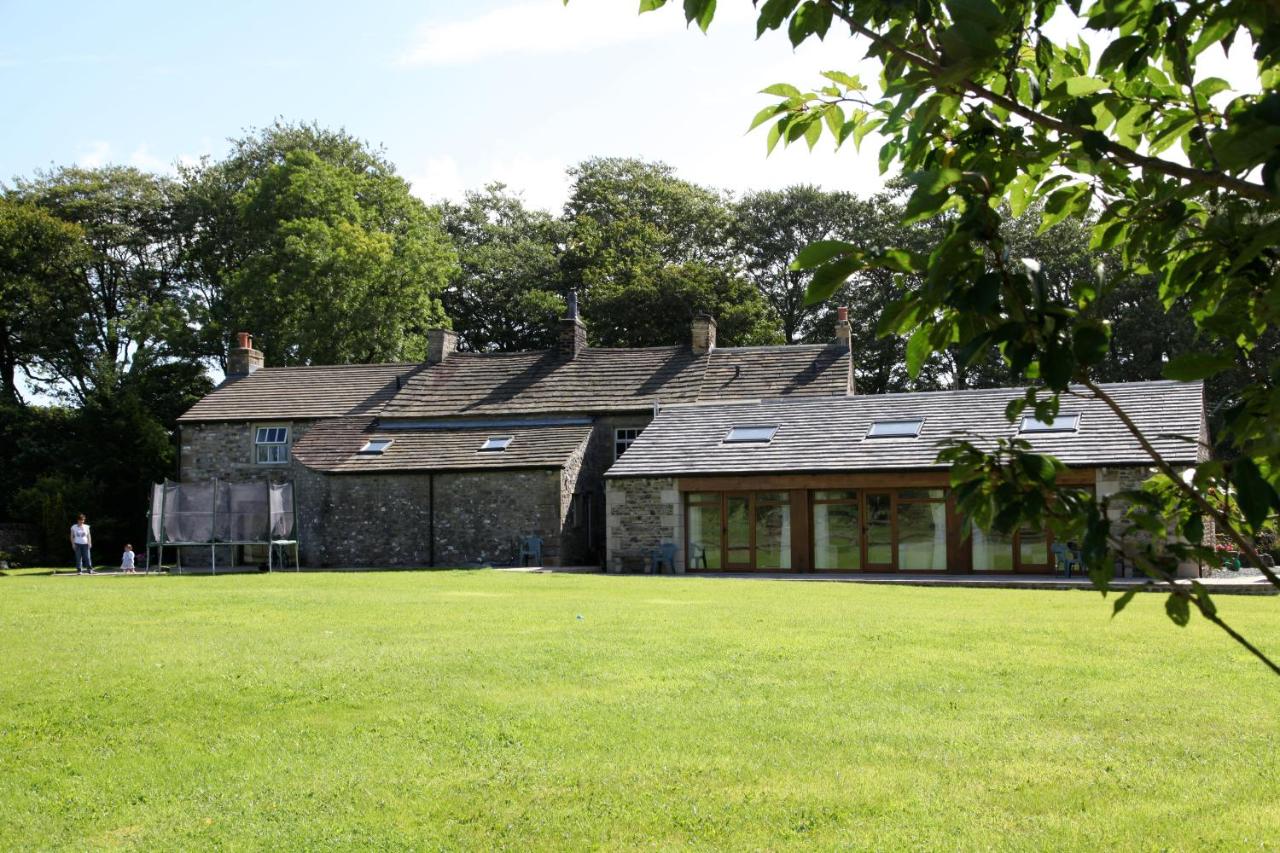
Malham YHA (sleeps 1+)
Offering everything you could possibly need, YHA Malham youth hostel is a budget-friendly option for solo travellers or groups. Dormitories, private rooms and even cute pod eco-cabins are available to book.
Heading to The UK Soon? Don’t forget these essentials!
Flights: compare and search using Skyscanner
Accommodation: hotels to hostels, glamping to apartments I always use Booking.com
Tours: to search and compare the best group tours and activities worldwide (with up to 20% off), use Viator
Visa: don’t forget to check the entry requirements for the passport you are travelling with
Inspiration: Lonely Planet’s guide to Great Britain or Lonely Planet’s guide to England
Wow! I can’t wait to do this. The cove is stunning, I love the little shops. Thanks for sharing for my bucket list haha
Oh yay, I’m glad 🙂
Amazing guide. I loved all the pro tips you gave. I will definitely do this walk in the future. Thanks for sharing!
Thanks Francesca 🙂
I love winter walks, and this one looks amazing. Honestly, the landscape is unlike most I’ve seen in the U.K. – so I would love to do this, and it is great there is a shorter and safer of the Malham Circular Walk for winter. Of course, I would love to end the day at the pub! Putting this on my list for the next time we are in the U.K.
It really is quite a unique geological area. The Scar is honestly breath-taking and makes you feel tiney tiny! All good walks end up in the pub!! Luckily Malham has a couple to choose from!
Blooming ‘eck this area is just so beautiful! It is such a beeeeautiful area! Malham Cove looks like such a fab area to explore with those massive cliffs, faerie waterfall and those clints and grykes. I love that you can still do this in the wintertime. Finishing at a pub is just the best part about hikes in the UK. 😉
Isn’t it just?! It has been on my radar for a while and I was so glad I managed to convince my family to come with me, even on a weather warning day! The geological formations are otherworldly! Agreed. All walks should end up in a pub, in one form or another!
The views there look amazing. I would really love to hike it.
I am always so grateful when people include distances and tips when describing hikes- thank you! Stunning photos
Gosh this looks so beautiful! I can’t believe how nice the weather was for you in January! Definitely doing this when I am in the area!
I had never heard about this walk before, let alone see pictures. It looks absolutely amazing and I wish I could go. I’ve been very into hiking and backpacking myself (I hiked 500 miles in 2021, which was a record for me), and I really love exploring new trails. This looks like a perfect addition to my hiking bucketlist.
Man, that’s such a beautiful hike! I love Janet’s Foss, it looks spectacular! I would definitely try this trek one day. Thanks for giving all the thorough details!