To kick off 2023 in style and set the tone for the rest of the year, my sister and I wanted to embark on a wholesome outdoor adventure over the long bank holiday weekend. As proud residents of northeast England, something epic to take advantage of and celebrate our beautiful surrounding landscapes was in order.
We decided to tackle the Cleveland Way, a 34 km/21 mile walk from Scarborough to Whitby along the coastline, with an overnight stop at the very cool YHA Boggle Hole.
And boy did we luck out with the most glorious winter sunshine and clear skies imaginable (though the endless thick mud was a reminder what season we were in!!).
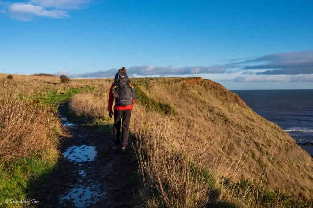
We had an absolute ball walking a section of the Cleveland Way and utterly revelled with childlike glee at non-stop dramatic coastal views which just got better and better as we went on.
Walking from Scarborough to Whitby is not at all a technical walk. It’s an extremely well signposted route (always lookout for signs towards the Cleveland Way) and aside from the extreme mud you can experience, it generally follows well-formed and highly-trafficked footpaths atop cliffs along the coastline.
Occasional crossings through scenic becks, sheep filled fields, cute villages and passing waterfalls and historic sites (and a few small but steep climbs), keeps this route ever-interesting.
So, if you fancy a challenging but accessible walk, you won’t regret this 21 mile route along some of Yorkshire’s most spectacular coastline.
Join us as we recount our journey along the Cleveland Way, walking from Scarborough to Whitby.
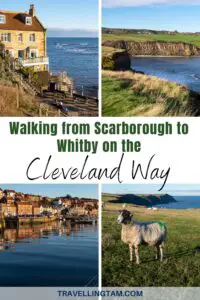
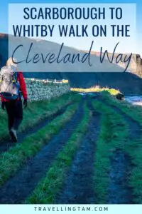
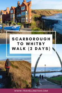
PIN FOR LATER:
Day 1: Scarborough to Boggle Hole – 13 miles/21km
Starting in Scarborough
Chucking our packs in the car, we set out before the crack of dawn to our start point in Scarborough (which considering we stayed up to see in the new year, was quite an impressive feat!).
This walk can begin anywhere along the Scarborough foreshore as the beachfront promenade is part of the Cleveland Way. Many people start the walk at the iconic vista of Scarborough Castle, a medieval royal fortress built on a promontory of rock jutting out into the North Sea
We however, began our walk further along the foreshore near Peasholm Park, where we were fortunate to find free winter parking.
Scarborough Castle has stood sentinel over Yorkshire’s coastline for over 3,000 years, having played a vital role in defending against civil wars, conflicts, and sieges from invaders such as the Scots and French.
Today, the fortress is an ancient monument of national importance, mainly in ruins, and is managed by the English Heritage. The castle imbues the otherwise ordinary seaside town of Scarborough with a sense of historical significance and grandeur.
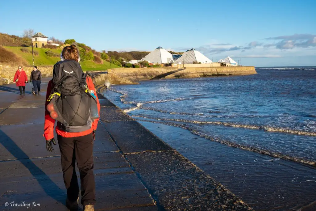
With the majestic castle looming on the horizon behind us, we set out along the foreshore, making our way north along the Scarborough promenade.
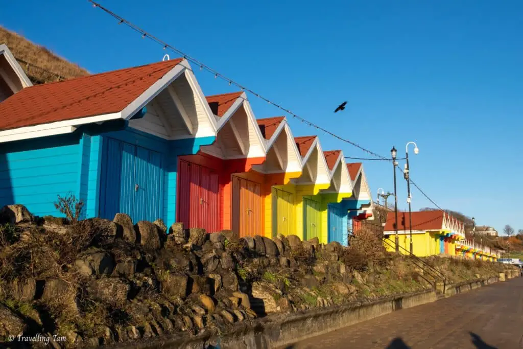
We passed brightly coloured beach huts and the Sea Life centre on our left, whilst enjoying the invigorating and rather brisk sea breeze.
In front of the Old Scalby Mill pub, we crossed a bridge over Scalby Beck and joined the footpath to take us over the top of the cliffs, where the impressive views (and our giddiness) commenced.
Joining the clifftop path
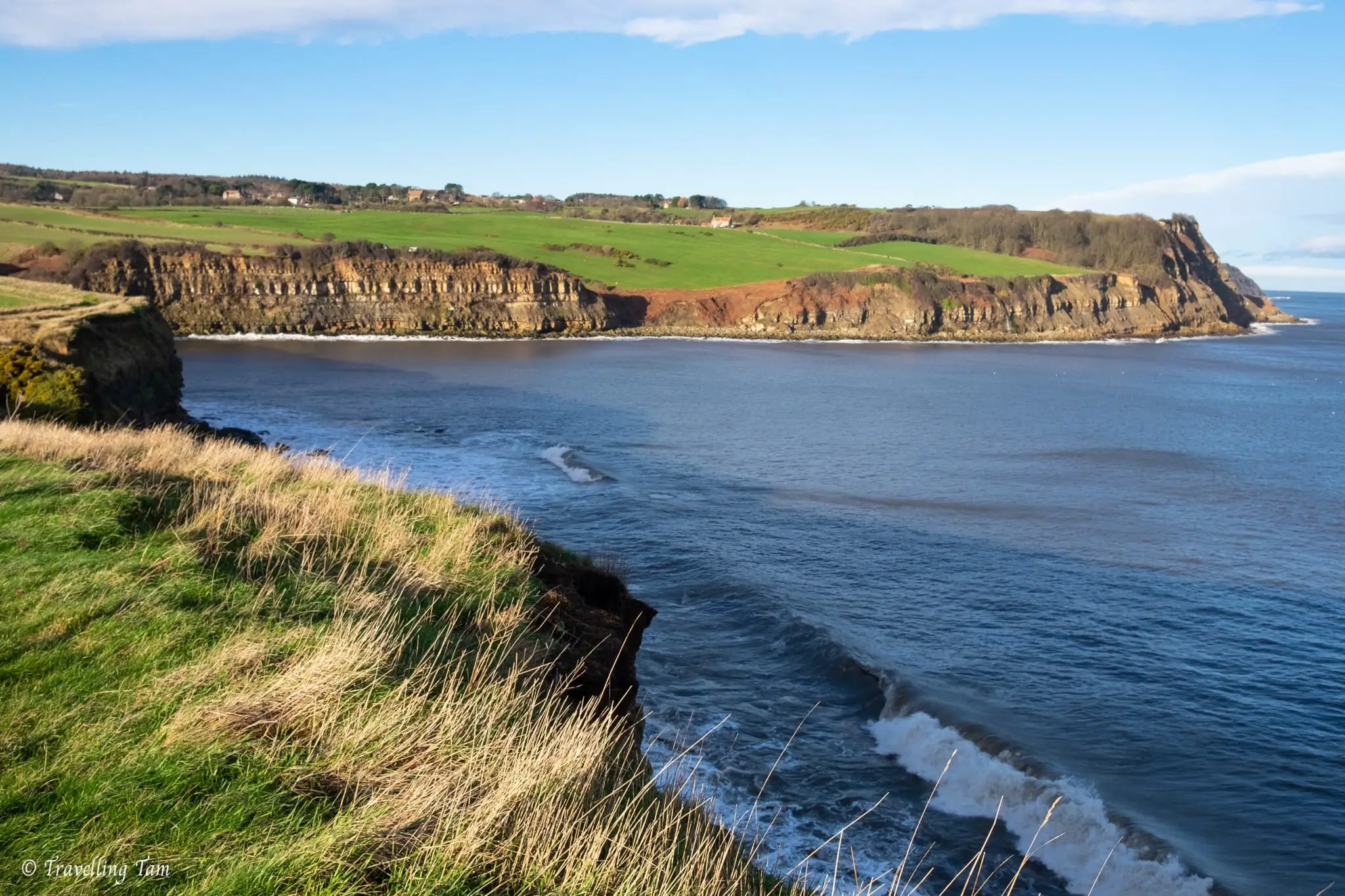
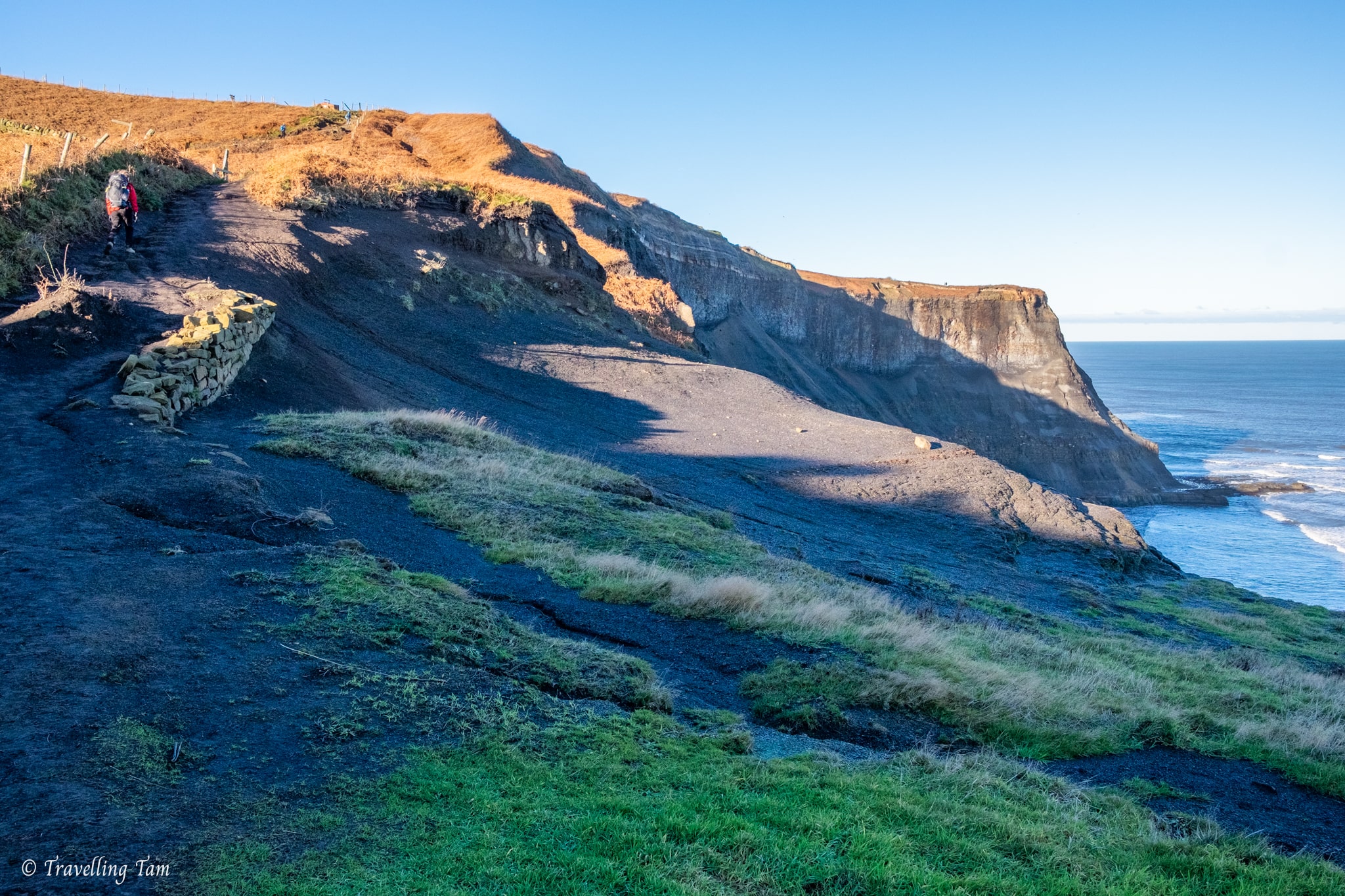
This initial section of the Cleveland Way footpath, aside from a brief initial incline, was relatively flat as we traversed the perimeter of grassy fields.
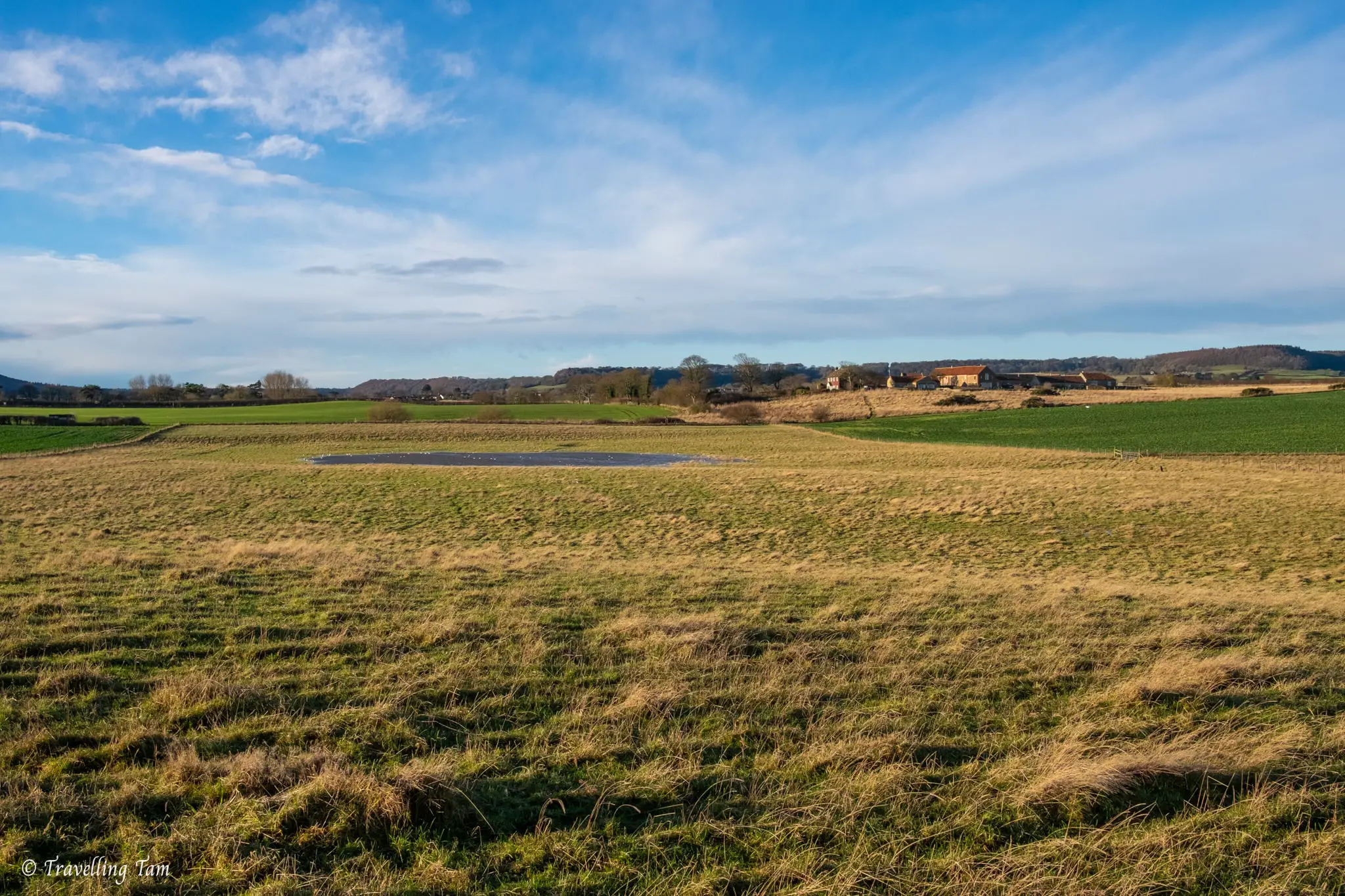
We passed by notable landmarks such as the Scalby Lodge pond, which despite it being winter, had diminished to a rather unimpressive small pool in a field. We also came across the Long Nab Bird Observatory, a former coastguard lookout, now a bird watching hide.
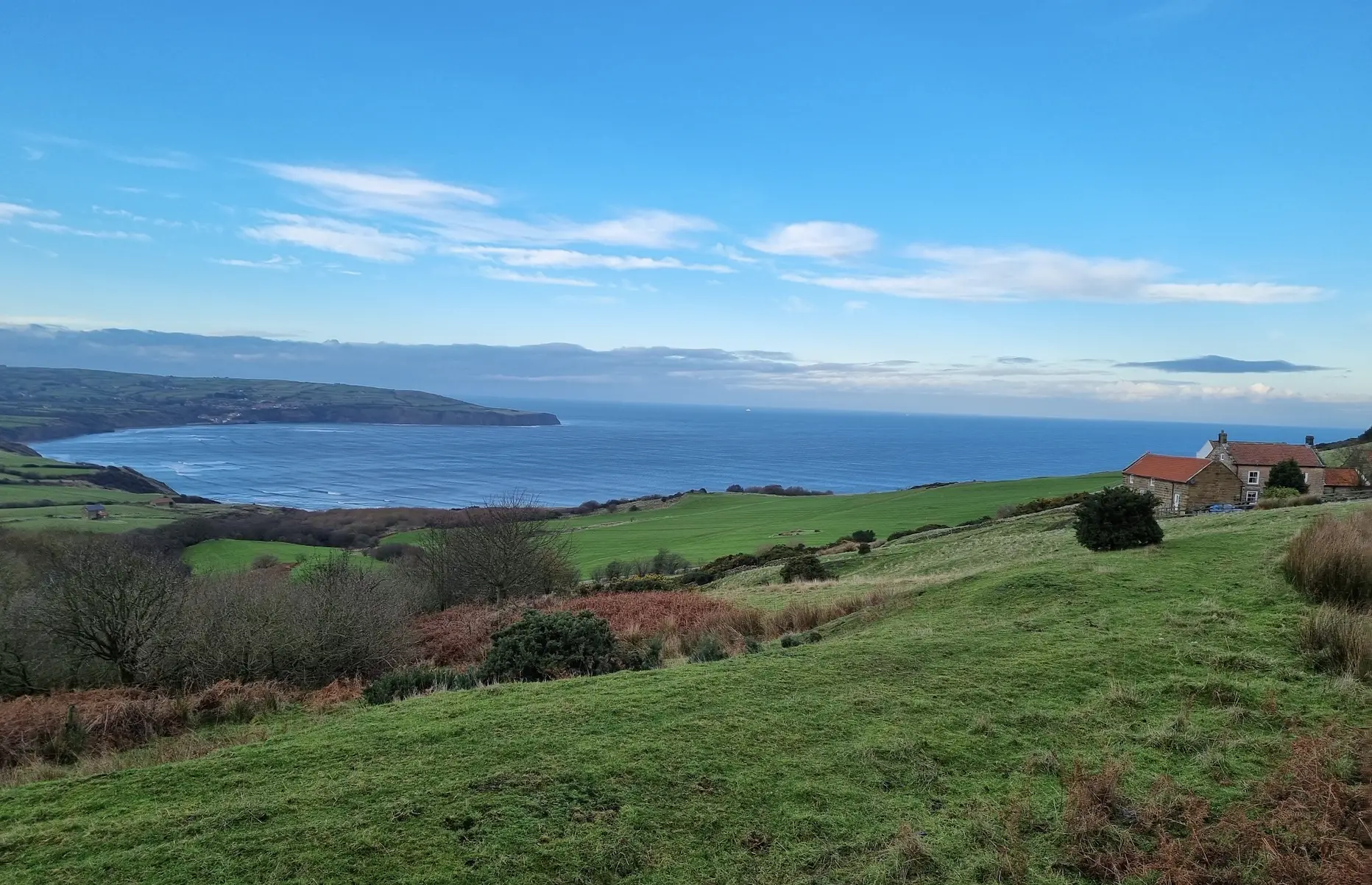
It was just past here, heading near to Cloughton, that the scenery changed to be a little more green and interesting as we entered the North Yorkshire Moors National Park. We also noticed the cliffs getting steeper and the terrain more varied with some short inclines to get the heart pumping.
Overall, this part of the walk from Scarborough to Whitby has about 745m of elevation gain (whereas day two has about 410m), so there are some steep sections.
Descending into Hayburn Wyke National Trust Woodland
Before long, the footpath along the exposed cliffs dipped into the pretty woodland of the National Trust managed Hayburn Wyke, a secluded valley and cove complete with a tumbling waterfall.
The woods here were once brimming with oak, ash and beech trees which were sadly felled in the 1940s to help with the war effort. They were replaced by conifers by the Forestry Commission, but when the National Trust purchased the land, they have since been thinning out the conifers and restoring the native species. They’ve done a great job – it was a really charming section of the walk and although you could tell it wasn’t ancient forest, it was quite well established with a variety of interesting flora.
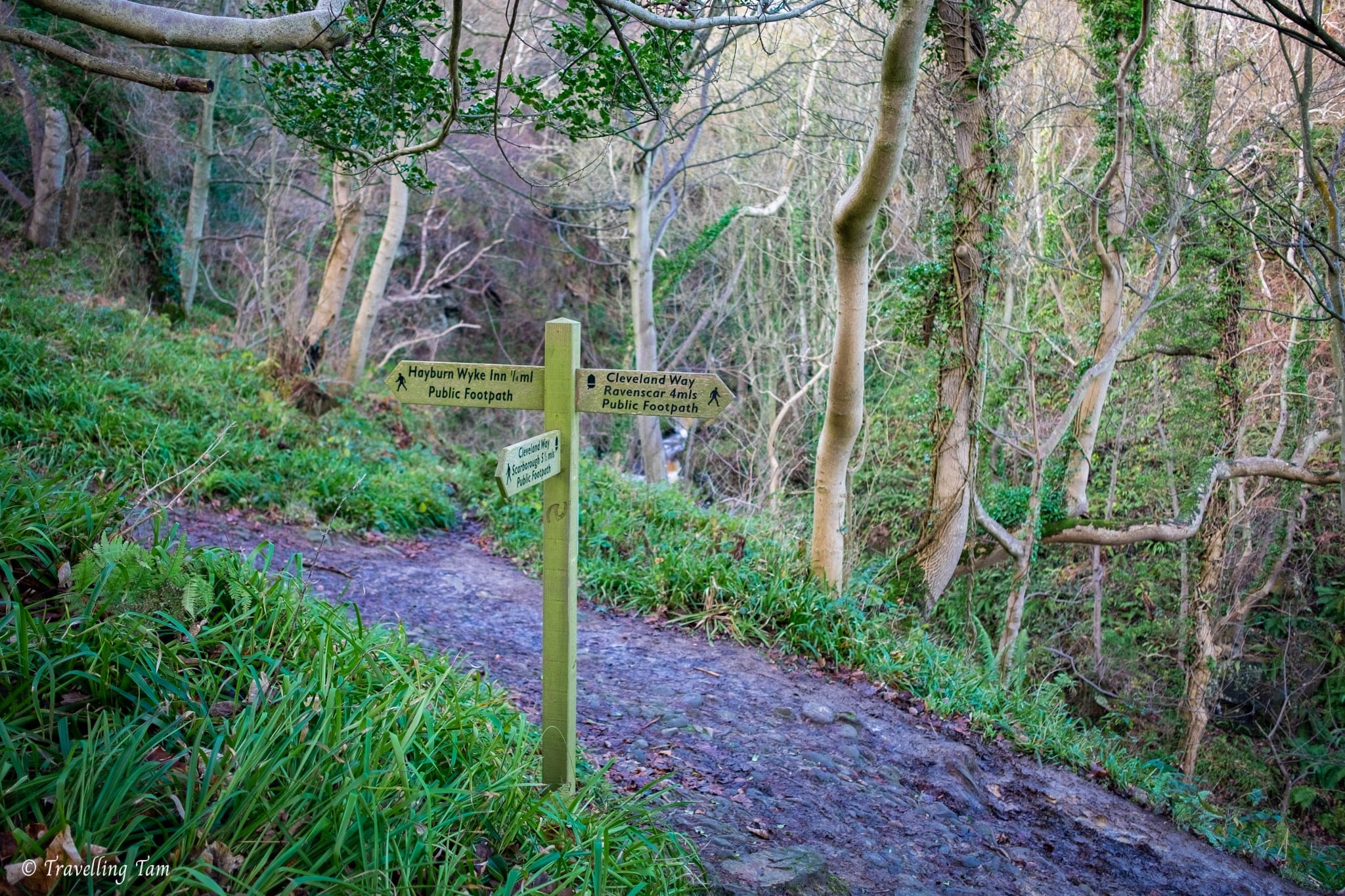
Following the sign in the direction of the Cleveland Way towards Ravenscar, we passed by the pebbled cove (and of course couldn’t resist a look at the beautiful dual-drop Hayburn Wyke Waterfall). Crossing a wooden bridge over Hayburn Beck, we embarked up on the steep wooden boardwalks and steps, ascending out of the damp and mossy wooded valley.
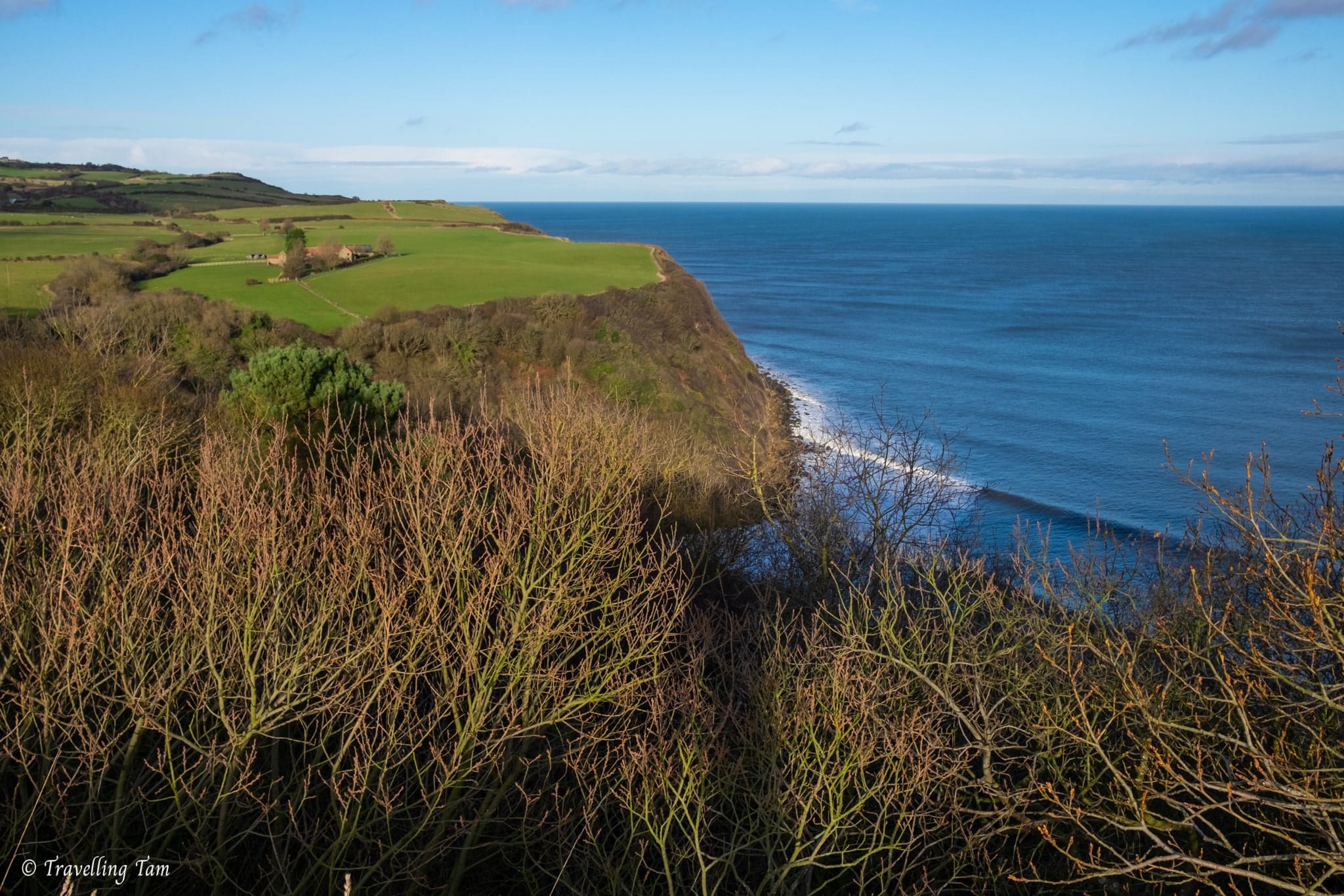
Approaching Ravenscar
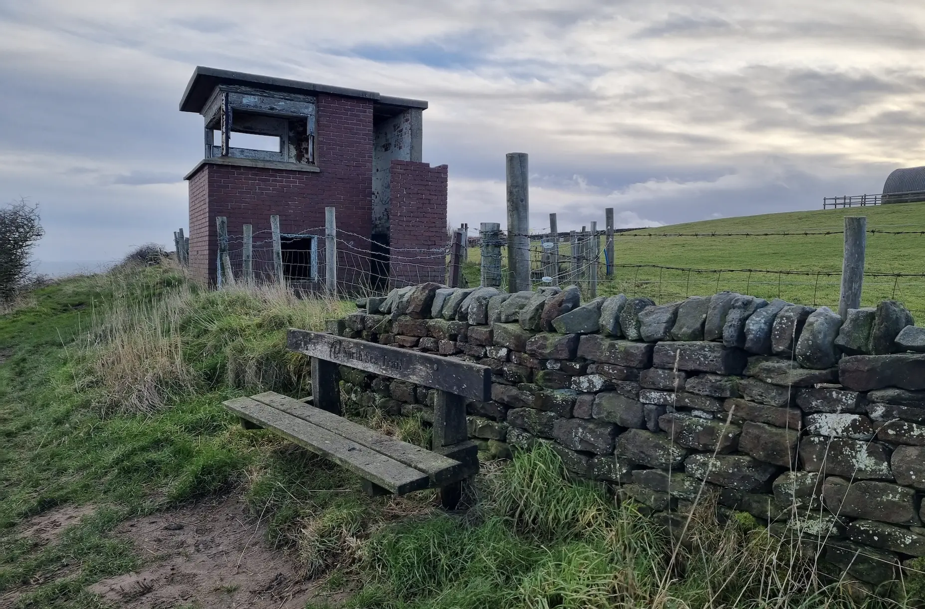
Back on the exposed clifftop path, the next most notable landmark was the remnants of the Ravenscar Radar Station, where we sat on a bench to have a snack, rehydrate, read the information boards and take a moment to enjoy the vastness of the ocean before us.
Ravenscar Radar Station (also known as Bent Rigg Radar Station) was a short range coastal defence system used during WW2 as an early warning system to detect craft flying close to the sea.
A few buildings remain to this day which you can have a nosey at, such as the brick semi-circular transmitter hut where the original radar was mounted on top of, and a hut beside the footpath, presumably a lookout, with a large cut out window with a sea view.
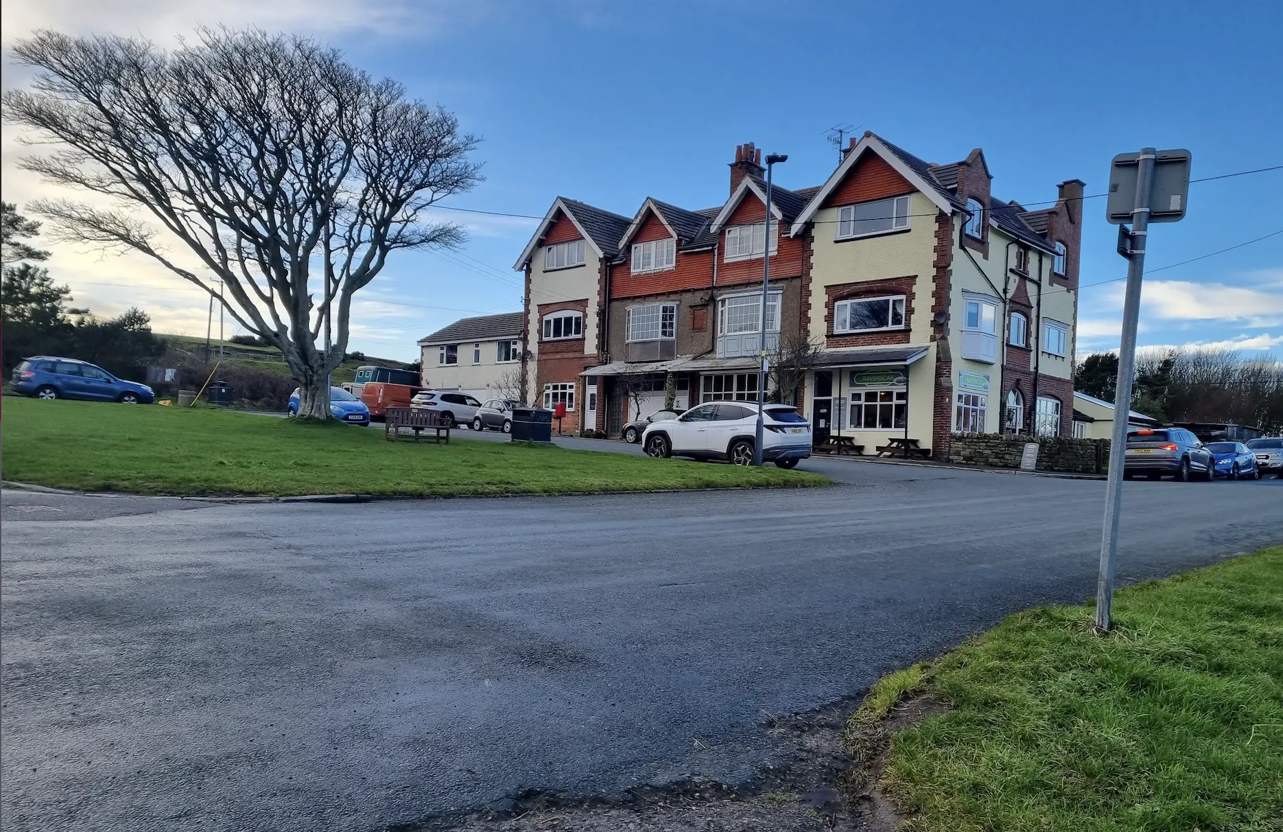
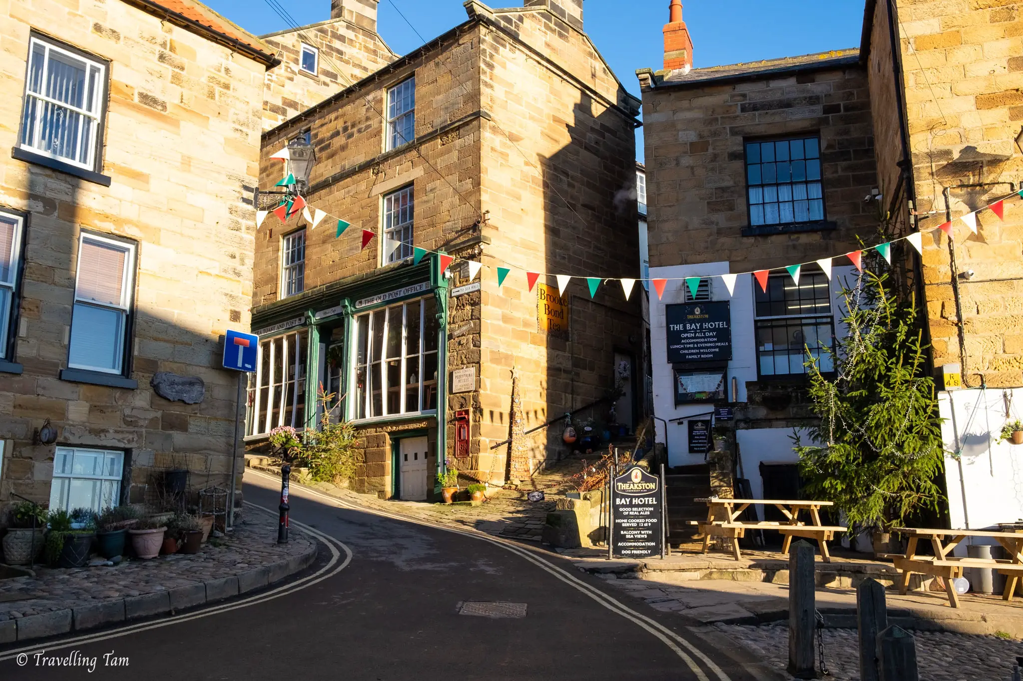
Next up, just over a mile later, was the town of Ravenscar itself, a funny little place which was initially built in Victorian times with the intention of being a resort that would rival seaside holiday towns like Scarborough and Whitby.
However due to the long trek to the rocky beach, development ceased beyond simply sewers and streets. It’s been developed a little bit more since, but it’s still very small. It’s home to around 60 people, with a couple of tea rooms and the magnificent Raven Hall, a large country house hotel with a golf course with panoramic coastal views and most notably – a seal colony at the bottom of the cliffs!
Joining a short cobbled section of the footpath by the Cinder Track, we could see the manicured lawn of the golf course with outstanding sweeping views to our right.
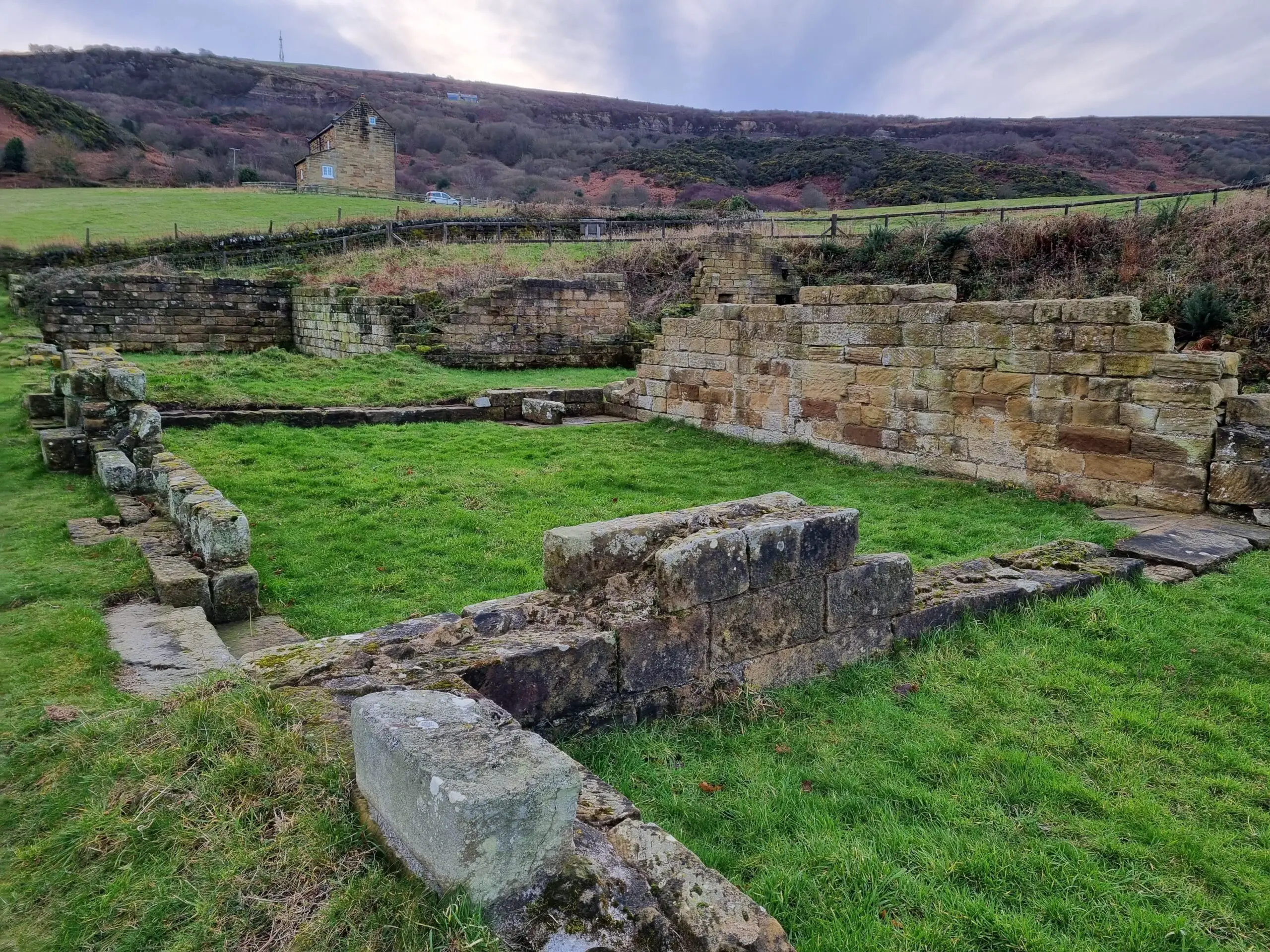
Soon, after a gentle downhill section, we reached the ruins of the Peak Alum Works which we diverted slightly off the Cleveland Way to visit.
Alum was quarried and processed here in a complex operation which involved roasted seaweed and aged human urine – lovely! The resulting alum substance was a binding agent used in tanning and dyeing to fix dye to cotton and other fabrics.
Reaching Boggle Hole for the night
After reading the information boards and walking around the Alum Works ruins for 10 minutes or so, we bid farewell to yet another historical landmark and continued through more muddy fields where, realising dusk was beginning to set in, we promptly picked up the pace.
Two miles and around 40 minutes later we arrived at the welcome sight of the very cool-looking YHA Boggle Hole hostel nestled between shallow cliffs, literally plonked right on the seafront.
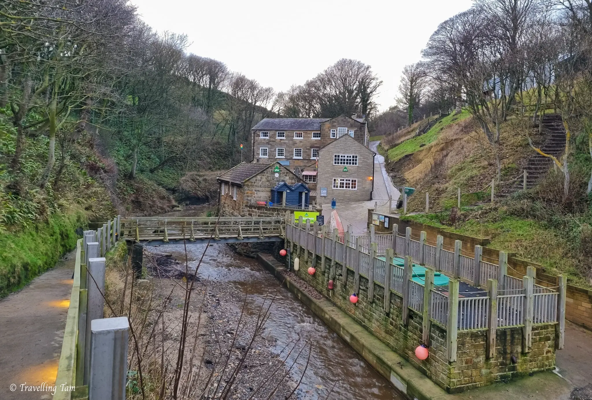
After checking in at the quirky ship-themed bar, we headed to our room in the ‘Crows Nest’, a modern addition 100m or so from the main building (which I was gutted to see was up a bank via a few flights of steep steps – typical!)
We were thoroughly impressed with our stay at YHA Boggle Hole. The quirky atmosphere, amenities, and overall cleanliness were top-notch. The hostel offered a well-equipped kitchen, allowing us to cook our own meals, as well as a cosy bar and dining area with a log burning stove. I’ve stayed in many hostels over the years and this one is stand-out (in the UK at least). Our room was comfortable, well thought out, and we had a restful night’s sleep as soon as our heads touched the pillow… I guess a day of fresh air and exercise will do that to you!
Day 2: Boggle Hole to Whitby – 8 miles / 13 km
Refreshed and refuelled with a hearty vegetarian full English breakfast, we commenced on the final, and shortest day of our walk. Yet again the sun was beaming in a cloudless sky overhead, adorning the deep blue North Sea with a glittering sheen.
Despite this section of the walk being the busiest with fellow walkers, my sister and I agreed that it was probably our favourite. The scenery is more epic than the Scarborough to Boggle Hole stretch and we loved going through Robin Hood’s Bay and seeing Whitby Abbey on the horizon as we neared the end of our walk.
Passing through Robin Hood’s Bay
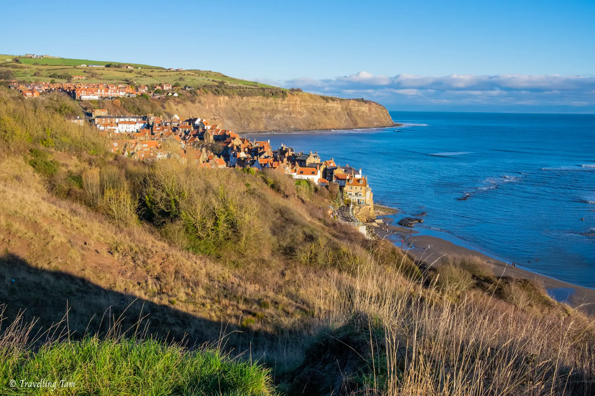
Only a few minutes after leaving Boggle Hole YHA, we arrived at Robin Hoods Bay. Although the Cleveland Way path splits off to the left, we decided to go right so we could walk through the heart of the town and rejoin the route a few hundred metres later.
The old fishing (and pirate) township of Robin Hood’s Bay is one of my favourite seaside towns. Its quaint time-warp shops and cottages along the sloped main street makes it brim with character. Walking through the little hidden laneways allows your imagination to run wild about the smuggling activities once rife here. And it’s small, which I think makes it feel less pretentious than Whitby somehow.
The downside to Robin Hood’s Bay is it’s the end point of the 190 mile Coast to Coast trail so it can often be quite busy with groups of walkers celebrating, on top of the normal hordes of tourists.
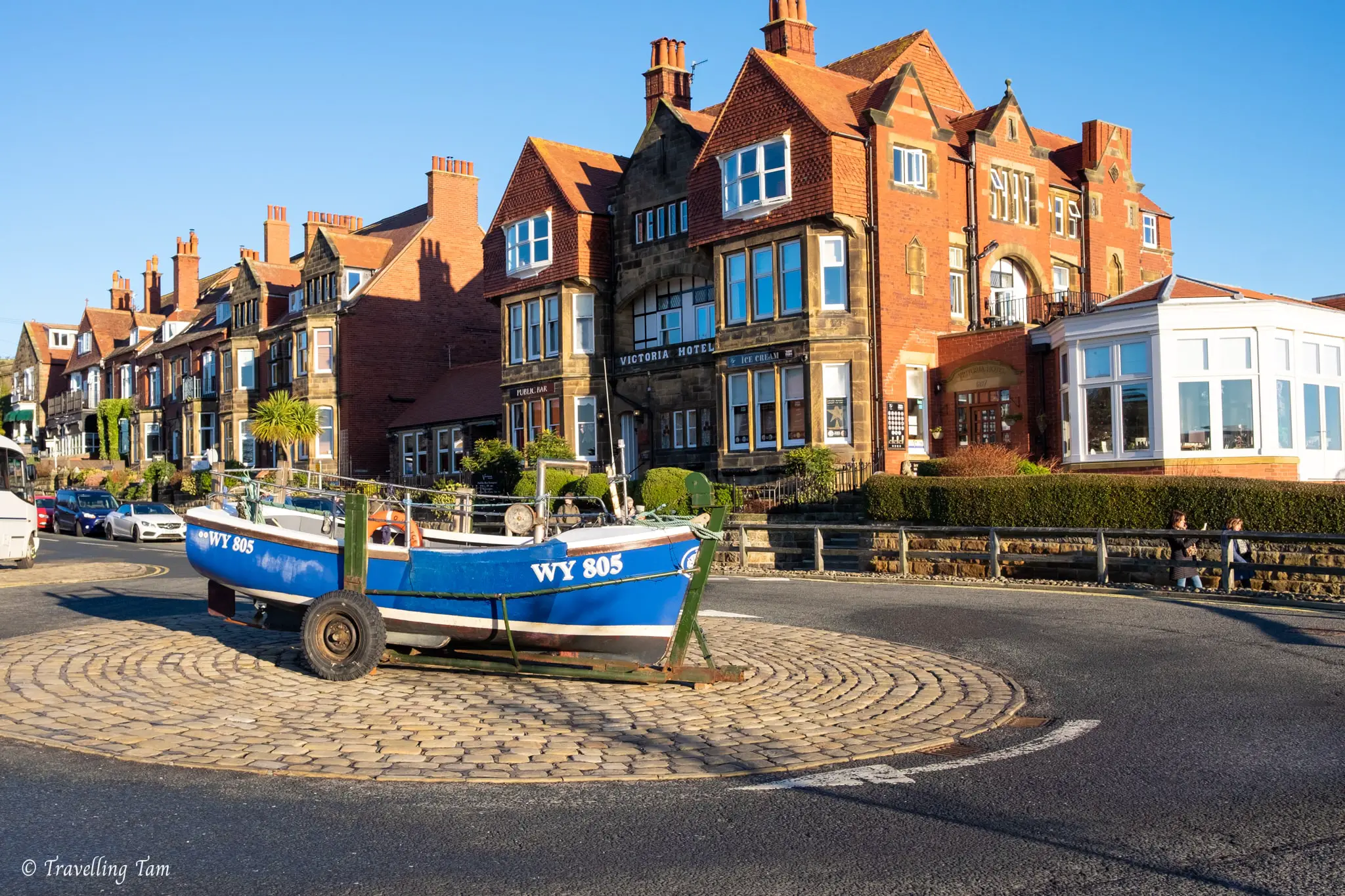
Once we made it up the hill we were required to pass the boat on the roundabout and walk along Station Road for a bit, before turning right along Mount Pleasant North where the off-road footpath began again. Back on the cliff top path, there was a great viewpoint of Robin Hoods Bay nestled in the nook between the cliffs.
Admiring changing geology
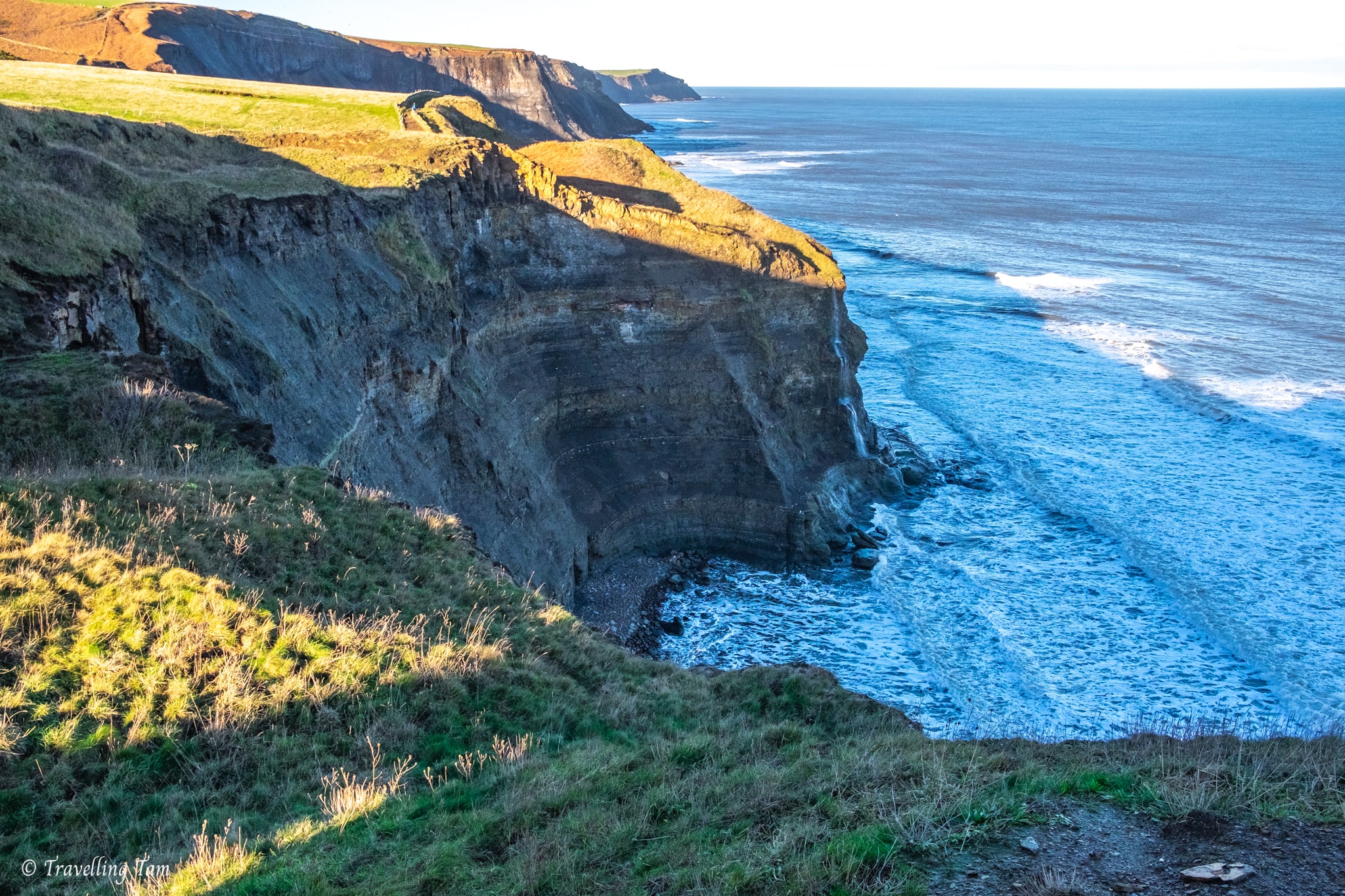
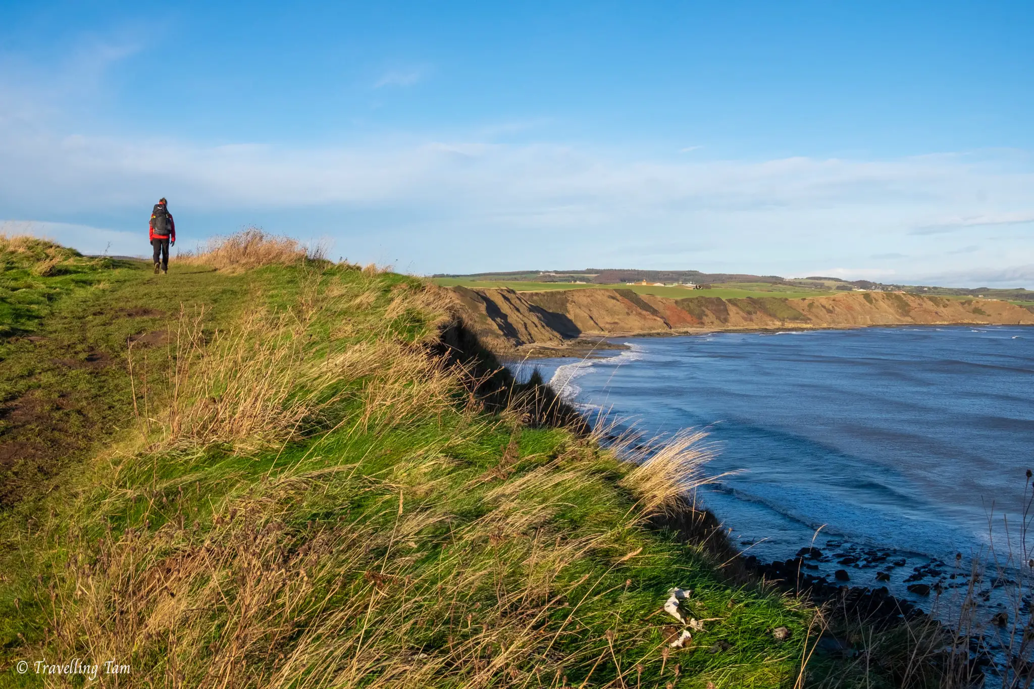
Before long, we noticed the geology of the area dramatically change around the Northcliffe area.
Cliffs that were previously pale yellow-orange sandstone were now deep black and higher, with more dramatic single-drop waterfalls tumbling along the cliff edges. I can imagine on an overcast day this section would have been very atmospheric and a bit creepy!
This part of the route was quite busy with day walkers, but seeing us with packs, most people stopped to chat to ask where we’d walked from and we found it pleasantly sociable!
Whitby Lighthouses
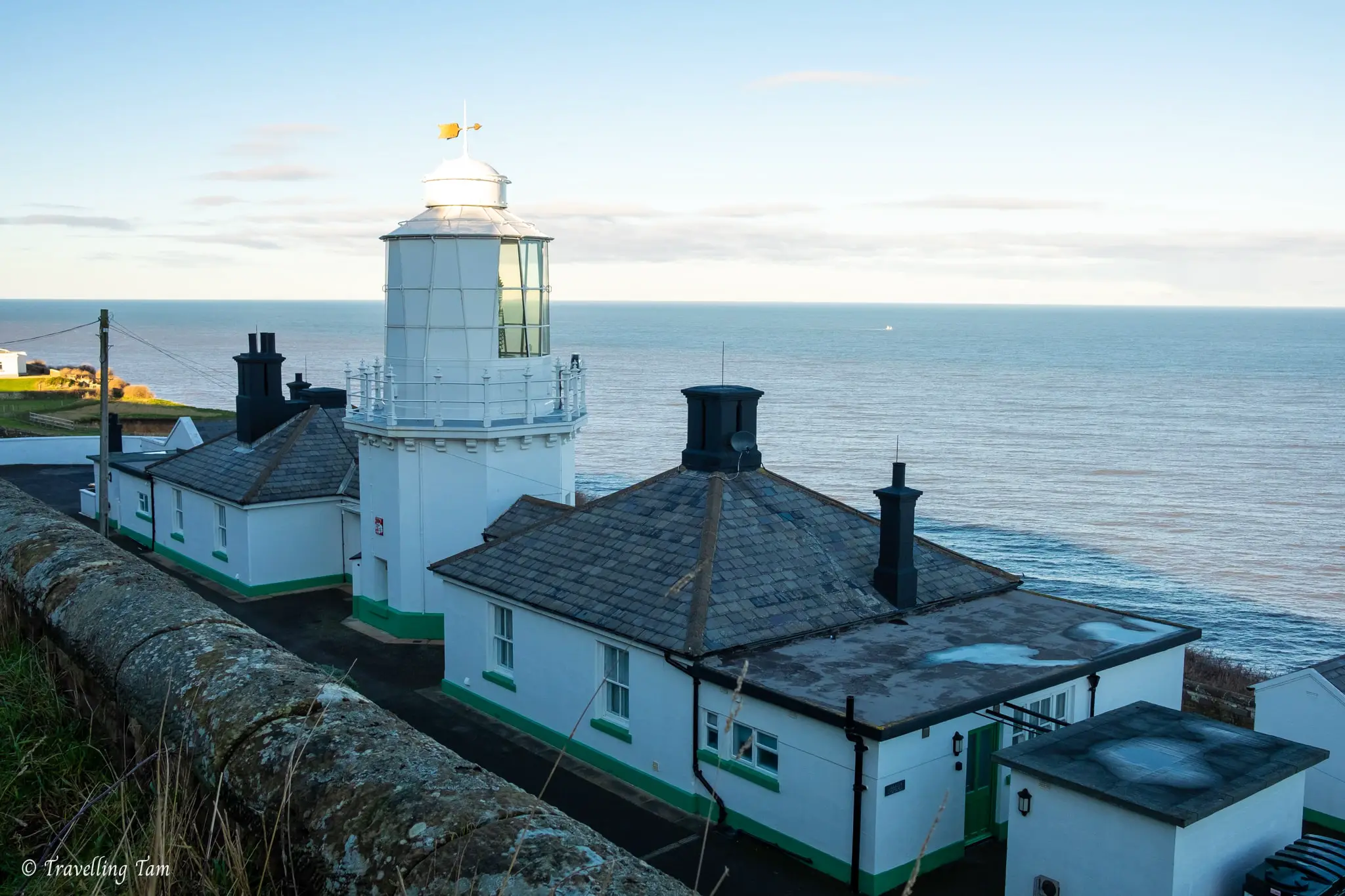
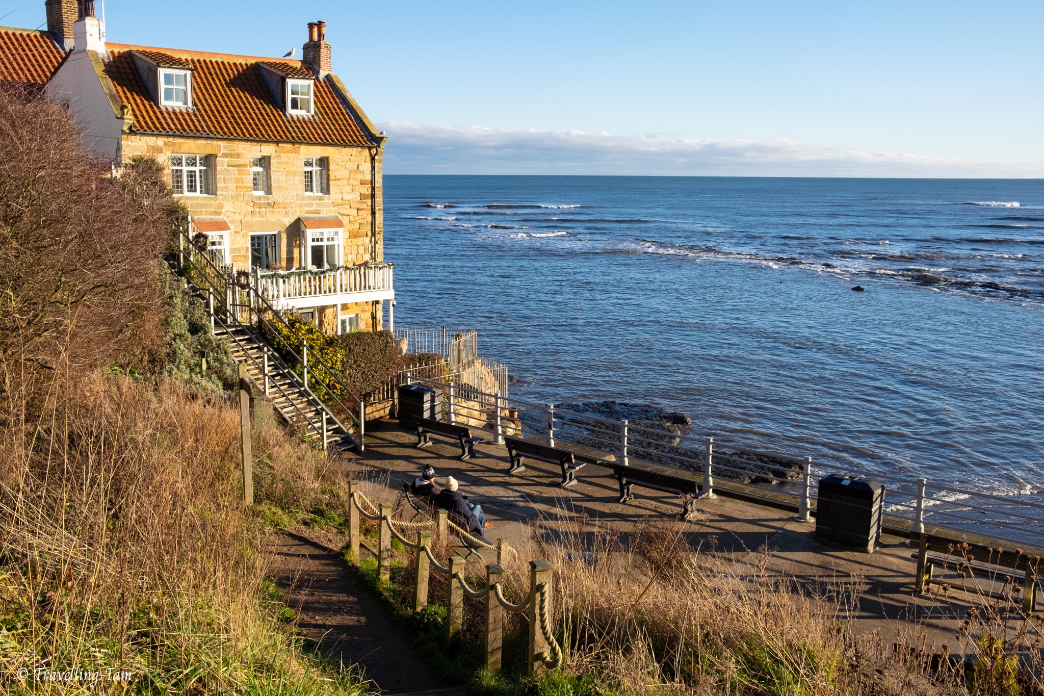
The next most notable landmark along the route was Whitby Lighthouse (now holiday accommodation called Vanguard & Galatea Cottages) and also Hornblower Lodge, formerly a fog signal station with huge metal trumpet sirens affixed to the top.
After a review of navigational aid requirements, the usage of the fog siren was discontinued in 1987 and was subsequently turned into a family home, then holiday cottages. The remoteness would definitely make this a wonderfully peaceful getaway.
Arriving into the centre of Whitby – the final stretch
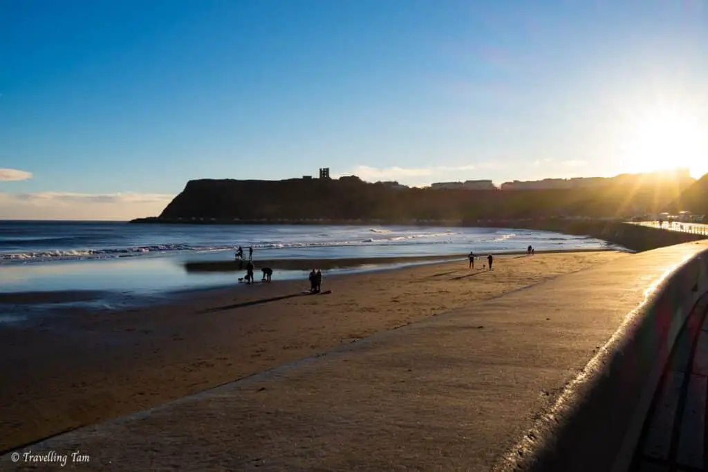
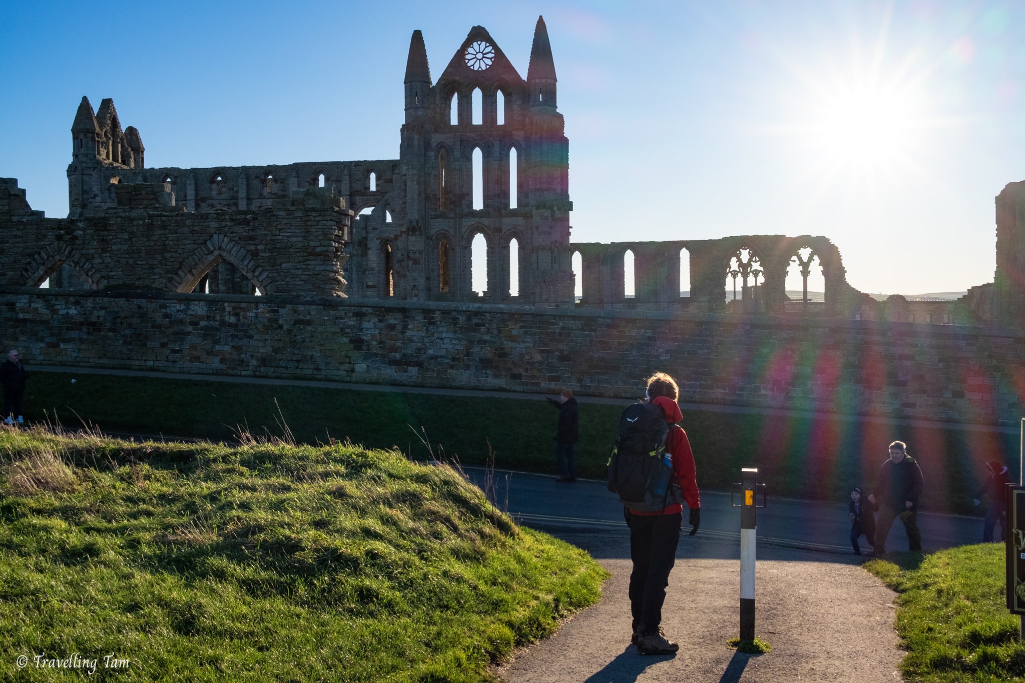
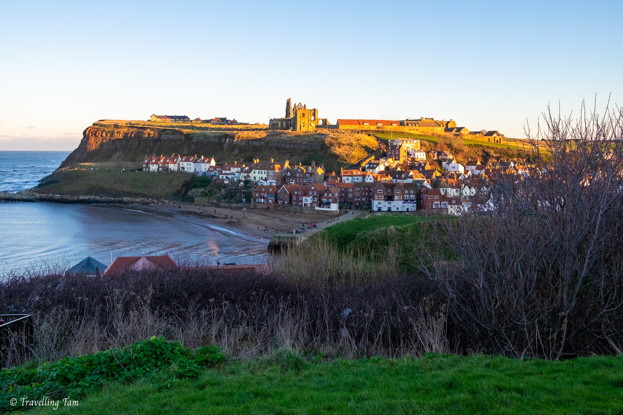
Around Saltwick Bay (a sandy bay famous for fossil hunting and shipwrecks) we saw the landmark which signalled the end was near – the ruins of Whitby Abbey on the horizon.
Passing through Whitby Holiday Park, we rejoined the coastal path and before long, ended right in front of the abbey. Founded in 657, it was once one of the most important religious centres in the Anglo-Saxon world.
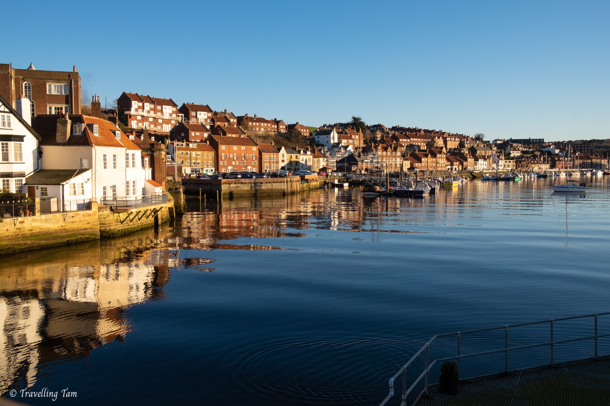
Down the cobbled road alongside Whitby’s famous 199 steps, we crossed the harbour on the packed Whitby Bridge and set eyes on Hope & Beans coffee shop, which was the ideal place for a sit down and a well deserved brew.
The coffee shop had a sleek and spacious atmosphere and the coffee absolutely did the job. The staff were also super sweet. Despite making a mess from our muddy walking boots, they wouldn’t let us sweep it up ourselves!
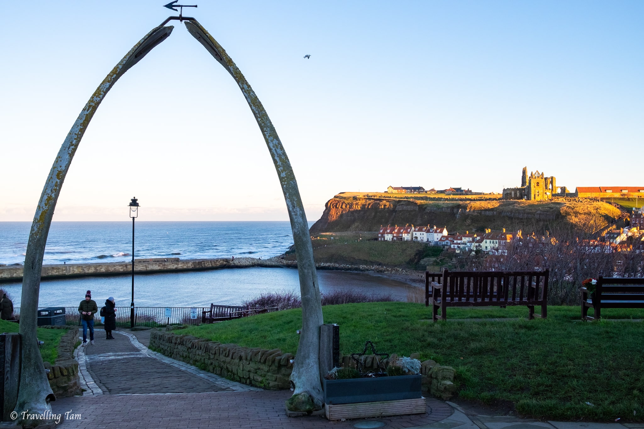
Refuelled and buzzing after completing our adventure, we had a few hours to kill before our train back, so we wandered around the wonky shops, and made it up to the Whale Bone Arch for a fantastic view over Whitby as golden hour engulfed the town.
On the train back from Whitby Station through the North Yorkshire Moors, we watched darkness blanket the countryside, feeling appreciative of the gift of Yorkshire’s spectacular countryside.
Walking from Scarborough to Whitby over a weekend was one of the most epic walks in the North Yorkshire Moors National Park I had ever experienced. For that reason (combined with the quality time spent with my little sister of course), I certainly won’t be forgetting it in a hurry. Now to uncover more epic multi-day walks in Yorkshire!
Walking from Scarborough to Whitby FAQs:
What is the Cleveland Way?
The Cleveland Way is a long-distance footpath that runs for 110 miles along the coast of North Yorkshire, England. The route starts in Helmsley and ends in Filey.
The path takes walkers through the North York Moors National Park, along the coast, and through the Howardian Hills Area of Outstanding Natural Beauty.
The Cleveland Way is considered one of the best long-distance footpaths in England, offering a challenging and rewarding experience for walkers of all abilities.
How long does it take to walk the Cleveland Way?
On average, it takes most people between 8-10 days to walk the Cleveland Way. This would involve walking for around 12-15 miles per day, with time for breaks. Some people take much longer such as 2-3 weeks to include sightseeing which involves walking 6-8 miles a day.
In this blog post, I cover only one section of walking the Cleveland Way, Scarborough to Whitby, which is often broken into two days.
Can you walk from Scarborough to Whitby in a day?
Yes, it is possible to walk the 21 mile route from Scarborough to Whitby along the Cleveland Way in a day however it would be a very long and challenging walk only suitable for extremely experienced long-distance hikers.
A high level of fitness, comfortable walking shoes and good preparation is required. It’s important to start early in the morning to make the most of the daylight hours. Perhaps it’s best tackled in the summer with longer days.
I personally wouldn’t recommend walking from Scarborough to Whitby in a day. The first section is challenging enough. Most people break up the walk like we did, with a night at Boggle Hole, which is 13 miles / 21km on day one, and 8 miles / 13 km on day two.
Are there any toilets between Scarborough and Whitby?
No, not really. You will only find toilets on the Cleveland Way between Scarborough and Whitby in the main towns you pass through which are Scarborough, Ravenscar, Boggle Hole and Whitby.
How long does it take to walk from Scarborough to Whitby?
With about 80% of the footpaths a sludgy muddy mess in January, it took us a total of eight hours to walk from Scarborough to Whitby. It took five hours to walk from Scarborough to Boggle Hole, and then around three hours from Boggle Hole to Whitby.
In better and drier conditions, it probably will take the average walker six to eight hours, walking three or four miles per hour.
Does the walk between Scarborough and Whitby get busy?
Yes, the walk between Scarborough and Whibty can get busy as it is a section of both the Cleveland Way National Trail and the Yorkshire Coast Path, which are two of the most popular long-distance trails in the UK. However, it really depends on the time of year and the day of the week you do it. Weekends in summer for example, will certainly be extremely busy.
If you’re looking to avoid crowds, you may want to consider going on a weekday or an off-peak season, such as Autumn or winter.
It’s worth noting that the accommodation at Boggle Hole is popular all year around. Reserving your lodgings for the night either here or in Robin Hood’s Bay well in advance is highly recommended.
What are the footpaths like between Scarborough and Whitby?
The footpath between Scarborough to Whitby is generally along the cliff top which is predominantly unfenced. It is advisable that you keep dogs on a short lead on these sections and also do not allow small children to walk near the edge or unaccompanied at any time.
The majority of the footpath is through fields or grassy land, so the footpaths can get really muddy after rain. There are some short sections on gravel paths, tarmac or stone steps, like when passing through Ravenscar or Robin Hood’s Bay. A good pair of walking boots for this varied terrain is essential.
MORE POSTS ABOUT YORKSHIRE:
- Wonderful Waterfalls to Visit in the Yorkshire Dales
- Stainforth Force to Settle River Walk
- The Most Unique Accommodation In Yorkshire
- The Malham Circular Walk: Janet’s Foss, Gordale Scar & Malham Cove
- Uncover The Bronte Sisters’ Yorkshire With A Day Trip To Haworth
- A Day Trip To Helmsley: The Prettiest Market Town In North Yorkshire
Heading to The UK Soon? Don’t forget these essentials!
Flights: compare and search using Skyscanner
Accommodation: hotels to hostels, glamping to apartments I always use Booking.com
Tours: to search and compare the best group tours and activities worldwide (with up to 20% off), use Viator
Visa: don’t forget to check the entry requirements for the passport you are travelling with
Inspiration: Lonely Planet’s guide to Great Britain or Lonely Planet’s guide to England
I loved all the info here… and beautiful photos. Who wouldn’t want to stay somewhere calle Boggle Hole!!?!?!?!? There are so many amazing trails in the UK. I’ve actually been stumped as to which one to do! This looks beautiful.
I do love the varied terrain and sites you see on this massive walk. Although I am a fan of natural coast side walks, the improved walkways and sculptures / amenities are lovely.
What a fabulous way to start the year! It may have been muddy, but it is really gorgeous even without the flowers and leaves on the trees. Are you tempted to come back and walk the entire Cleaveland Way now?
What a fantastic walk. I didn’t know about this when I was there so will have to do it next time. Thanks for sharing.
Wow! There is such variety on this walk it’s really impressive. From the colorful houses to the beautiful cliff views, it really does have it all! This must have been a magical weekend
The hike from Scarborough to Whitby along the coastline on the Cleveland Way looks stunning. Although I am not sure about making the full 34km hike – even if it is not a technical hike. So many fascinating sights along the way. Maybe we could try the section from Boggle Hole to Whitby.
This looks like a beautiful coastal walk! Not been to this area before but I’d love to visit it.